
Introduction
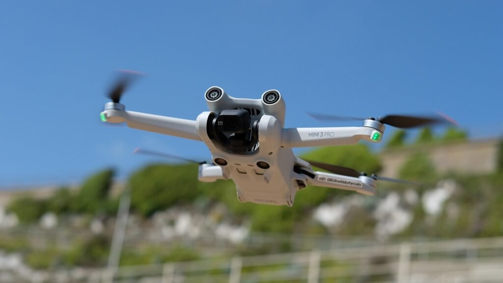
Overview of drone services
Drone services have revolutionized the field of surveying and mapping, breaking down traditional barriers and allowing for more efficient and accurate data collection. With the ability to capture high-resolution aerial images and gather data in real-time, drones have greatly improved the speed and cost-effectiveness of surveying projects. Additionally, they can access hard-to-reach areas and capture data from multiple angles, providing a comprehensive and detailed view of the terrain. Drone services have become an invaluable tool in various industries, including construction, agriculture, and environmental monitoring, enabling professionals to make informed decisions based on accurate and up-to-date information.
Importance of surveying and mapping
Surveying and mapping play a crucial role in various industries, and the importance of these activities cannot be overstated. By accurately measuring and mapping terrain, buildings, and other features, surveying enables better land management, infrastructure development, and resource exploration. It provides valuable data for urban planning, construction projects, environmental assessments, and disaster management. In the context of drone services, surveying and mapping have become even more revolutionary. Drones equipped with advanced sensors and cameras can quickly and efficiently capture high-resolution images and data, allowing for more accurate and detailed surveys. This not only saves time and costs but also enhances safety by reducing the need for manual surveying in potentially hazardous areas. In summary, surveying and mapping are the backbone of modern surveying and mapping services, and their importance cannot be ignored in today’s rapidly evolving technological landscape.
Advantages of using drones
Drones offer several advantages in the field of surveying and mapping. Firstly, they provide unmatched efficiency and accuracy. With their ability to reach remote and inaccessible areas, drones can quickly gather data and create highly detailed maps and surveys. This saves time and reduces costs compared to traditional surveying methods. Additionally, drones are equipped with high-resolution cameras and sensors, enabling them to capture precise measurements and identify changes in the landscape. Furthermore, drones are flexible and can be programmed to follow specific flight paths, capturing data from multiple angles and perspectives. Overall, the use of drones in surveying and mapping revolutionizes the industry by providing faster, more accurate, and cost-effective solutions.
Applications of Drone Services

Agriculture and crop monitoring
In recent years, drone services have revolutionized the field of agriculture and crop monitoring. With the ability to capture high-resolution aerial imagery, drones provide farmers and researchers with a comprehensive view of their crops, allowing for early detection of plant diseases, assessment of crop health, and optimization of irrigation and fertilization processes. Furthermore, the use of drones reduces the need for manual labor and saves time and costs associated with traditional field monitoring methods. As a result, farmers are able to make timely and data-driven decisions, ultimately leading to increased crop yields and improved sustainability in the agricultural industry.
Construction site mapping
Construction site mapping is a critical aspect of any construction project. By utilizing drone services, construction companies are breaking barriers and revolutionizing the way mapping and surveying are done. Drones offer a cost-effective, efficient, and accurate solution for capturing detailed site data. With aerial imagery and 3D mapping capabilities, construction professionals can quickly assess the topography, monitor progress, and identify potential issues on construction sites. This technology not only saves time and money but also enhances safety by reducing the need for workers to physically inspect hazardous areas. Construction site mapping with drones is empowering the industry to optimize project management and decision-making, leading to improved productivity and quality of construction projects.
Environmental monitoring
Environmental monitoring is an important application of drone services in the field of surveying and mapping. Drones have revolutionized the way environmental data is collected and analyzed, making it more efficient and accurate. With the ability to access hard-to-reach areas and capture high-resolution images, drones are able to provide valuable insights into the condition of the environment. They can be used to monitor air quality, detect changes in vegetation, survey wildlife populations, and identify potential pollution sources. The data collected by drones can help scientists and policymakers make informed decisions to protect and preserve our natural resources. Overall, drone services have proven to be a powerful tool in enhancing environmental monitoring efforts.
Challenges in Drone Surveying and Mapping

Regulatory restrictions
Regulatory restrictions play a crucial role in the drone services industry, especially in the field of surveying and mapping. As drones become more widespread and accessible, it is important for governments and regulatory authorities to establish clear guidelines and limitations for their use. These restrictions are put in place to ensure the safety of both operators and the public, as well as protect privacy and prevent any misuse of drones. Adhering to these regulations allows businesses and professionals in the surveying and mapping industry to operate legally and with confidence, ultimately contributing to the successful integration of drones into this field.
Technical limitations
In the realm of drone services, there are certain technical limitations that need to be acknowledged. While drones have revolutionized surveying and mapping, they are not without their constraints. One such limitation is battery life. Drones can only stay airborne for a limited period of time before needing to recharge. This can be problematic, especially when conducting large-scale surveys or mapping vast areas. Another challenge is payload capacity. Drones have a limited carrying capacity, which restricts the type and size of equipment that can be mounted on them. Additionally, weather conditions can have a significant impact on drone operations. Strong winds, rain, or extreme temperatures can hinder the performance and stability of these devices. Despite these limitations, the advantages offered by drone services in surveying and mapping far outweigh the challenges they present, making them an invaluable tool in the industry.
Data processing and analysis
Data processing and analysis play a crucial role in the world of drone services, especially in the field of surveying and mapping. Once the data is collected by the drones and cameras, it needs to be processed and analyzed to extract valuable insights and information. This process involves using sophisticated software tools and algorithms to transform raw data into accurate and detailed maps, models, and reports. Through data processing and analysis, drones are able to break barriers by providing faster, more cost-effective, and highly accurate results compared to traditional surveying and mapping methods. With the ability to collect massive amounts of data in a short period of time, drones have revolutionized the surveying and mapping industry, enabling professionals to access previously inaccessible areas and obtain critical information for various applications such as urban planning, infrastructure development, and environmental monitoring.
Emerging Technologies in Drone Surveying and Mapping

LiDAR technology
LiDAR technology plays a crucial role in revolutionizing the field of surveying and mapping. By using laser beams to measure distances and create highly accurate 3D models of the terrain, LiDAR enables surveyors and mappers to capture detailed information with unparalleled precision. Its ability to penetrate dense vegetation and capture elevation data makes it particularly useful for aerial mapping and environmental monitoring. Moreover, the data collected through LiDAR technology can be easily integrated into Geographic Information Systems (GIS) to facilitate data analysis and decision-making processes. With its remarkable capabilities, LiDAR is changing the way professionals in various industries, from urban planning to agriculture, approach surveying and mapping projects.
Artificial intelligence and machine learning
Artificial intelligence and machine learning have revolutionized various industries, and the field of surveying and mapping is no exception. By leveraging the power of AI and ML algorithms, drone services have been able to break barriers and streamline the surveying and mapping process. These advanced technologies enable drones to autonomously navigate through difficult terrains, collect high-resolution imagery, and analyze large datasets with incredible accuracy and efficiency. The integration of AI and ML algorithms with drone services has not only improved the speed and accuracy of surveying and mapping projects but has also reduced costs and minimized human error. As a result, industries such as construction, land development, agriculture, and environmental monitoring are benefiting tremendously from the use of drone services powered by AI and ML.
Real-time data visualization
Real-time data visualization is one of the key benefits of using drone services in surveying and mapping. With the capability to capture and transmit data in real-time, drones provide a valuable tool for visualizing and analyzing the data collected during surveys. This allows surveyors and mappers to make quicker, more informed decisions based on up-to-date information. By seeing the data in real-time, professionals can identify and address any issues or areas of interest immediately, increasing efficiency and accuracy in the surveying and mapping process. Additionally, real-time data visualization can also enhance communication between surveyors, mappers, and clients by providing a clear and comprehensive representation of the survey results. Overall, the adoption of drone services and real-time data visualization is revolutionizing the field of surveying and mapping, breaking barriers and opening up new possibilities for accurate and efficient data collection.
Future Trends in Drone Services

Integration with Internet of Things (IoT)
Integration with Internet of Things (IoT) is a key aspect of drone services in the field of surveying and mapping. With the advancements in technology, drones are now capable of seamlessly connecting and exchanging data with various IoT devices, such as sensors and trackers. This integration enables drones to collect real-time information and feed it directly into mapping and surveying systems. By utilizing the power of IoT, drone services are able to enhance their capabilities and provide more accurate and efficient surveying and mapping solutions. This integration also opens up new opportunities for automation and optimization in these industries, as drones can be programmed to perform specific tasks based on the data received from IoT devices. Overall, the integration of drones with IoT is revolutionizing the surveying and mapping industry by breaking barriers and enabling new levels of efficiency and accuracy.
Autonomous drones
Autonomous drones have revolutionized the field of surveying and mapping. Gone are the days of manually operated drones that required constant human intervention. With advancements in technology, these unmanned aerial vehicles can now navigate and perform tasks autonomously, making the process of data collection and analysis more efficient and accurate. By employing sophisticated sensors and advanced AI algorithms, autonomous drones are capable of capturing high-resolution images, creating 3D models, and generating accurate maps with minimal human effort. This has not only reduced costs and time but also improved the safety of surveying and mapping operations. The use of autonomous drones has truly broken barriers by enabling access to remote or hazardous areas that were previously inaccessible, allowing for more comprehensive surveys and mapping in various industries such as construction, agriculture, and environmental monitoring.
Enhanced data accuracy and resolution
Enhanced data accuracy and resolution are two key advantages offered by drone services in the field of surveying and mapping. Drones equipped with advanced sensors and imaging technologies are able to capture highly detailed data from various angles and altitudes, resulting in more precise measurements and mapping. This enhanced accuracy and resolution not only improves the overall quality of surveying and mapping projects but also enables a deeper analysis of the collected data, leading to better decision-making and planning. By utilizing drone services, surveyors and mappers can take advantage of this enhanced data accuracy and resolution to overcome traditional limitations and break barriers in their work.
Conclusion

Summary of key points
Drone Services: Breaking Barriers in Surveying and Mapping
Potential impact on surveying and mapping industry
The potential impact of drone services on the surveying and mapping industry is significant. Drones have revolutionized the way surveying and mapping tasks are conducted by offering a faster, more accurate, and more cost-effective solution. With drones, surveyors and mappers can easily cover large areas and capture detailed aerial imagery in a fraction of the time it would take using traditional methods. This increased efficiency leads to reduced project timelines and costs, making surveying and mapping services more accessible to a wider range of industries. Furthermore, the high-resolution imagery obtained from drones allows for better visualization and analysis, enabling more informed decision-making in various sectors such as construction, infrastructure development, agriculture, and environmental monitoring. The use of drones also enhances safety by eliminating the need for surveyors to physically access hazardous or hard-to-reach areas. Overall, the integration of drone services in the surveying and mapping industry has the potential to transform the way these tasks are performed, making them more efficient, cost-effective, and technologically advanced.
Future prospects of drone services
Drones have revolutionized surveying and mapping services and the future prospects for this technology are truly exciting. With advancements in drone technology, we can expect to see increased efficiency, accuracy, and affordability in surveying and mapping. Drones have already proven their value in various industries such as construction, agriculture, and disaster management. In the future, we can anticipate the expansion of drone services to areas like urban planning, environmental monitoring, and infrastructure inspection. The ability of drones to capture high-resolution images and collect data from hard-to-reach locations makes them invaluable tools for professionals in these fields. Moreover, the development of AI-powered data analysis and autonomous flight capabilities will further enhance the capabilities of drone services. As the demand for fast, cost-effective, and reliable surveying and mapping solutions continues to grow, the future of drone services looks incredibly promising.


