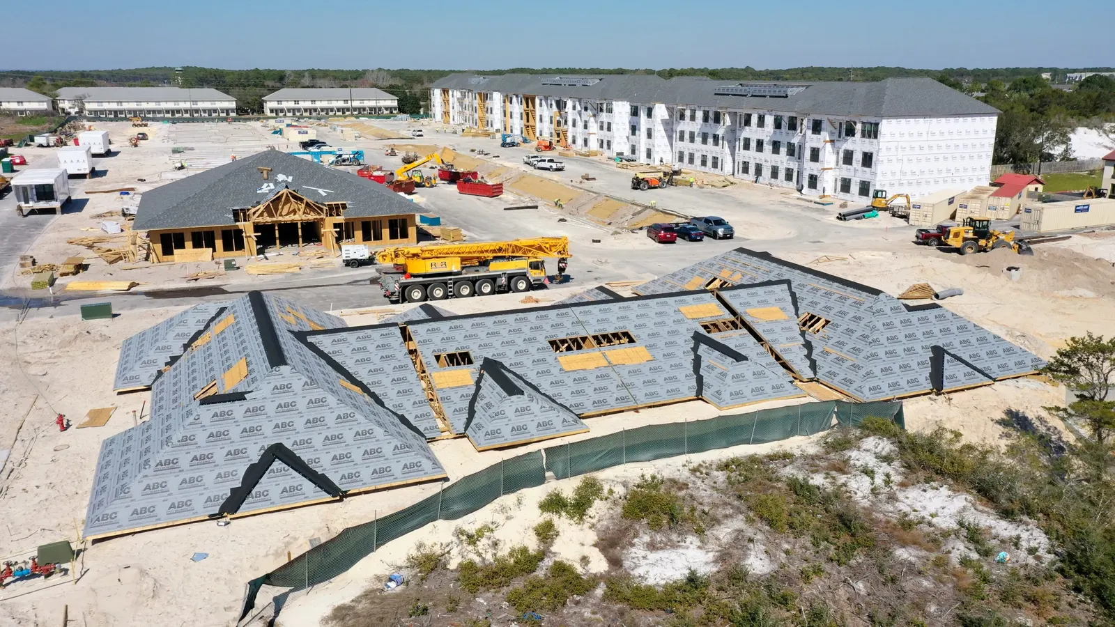
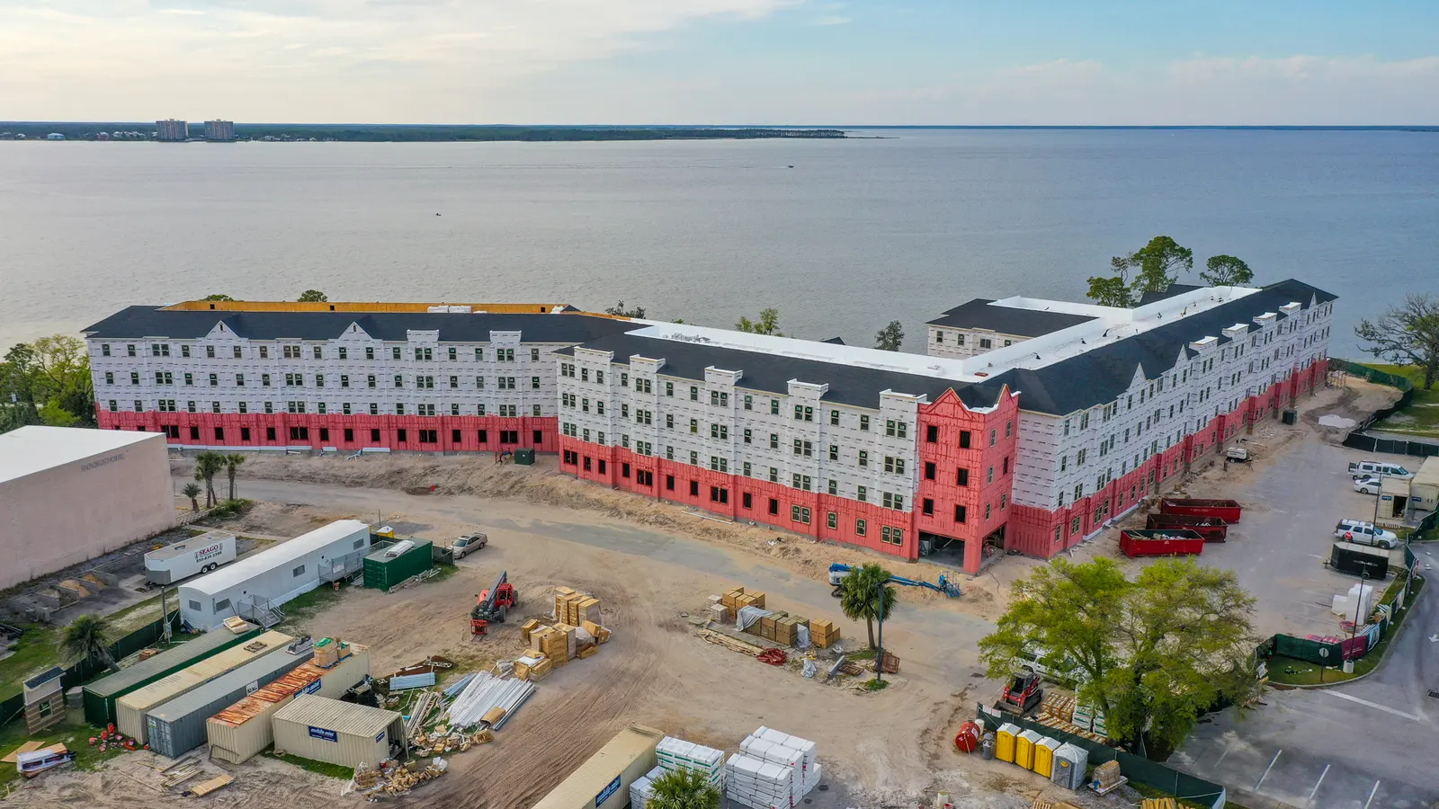
Aerial progress photos
Site-wide overviews and closer building or work-area views, including the milestones you want to document as construction moves ahead.

For builders, developers & property owners
Give owners and project teams a clear record of what changed on site. Emerald Coast Drone Pros provides construction progress photography and drone updates in Panama City Beach and across the surrounding counties. Dated overviews, repeat viewpoints, and selected detail photographs help you explain visible progress, prepare stakeholder updates, and keep a dated history of each work area.
Based in Panama City Beach · Bay, Walton, Okaloosa & Gulf counties
Overview
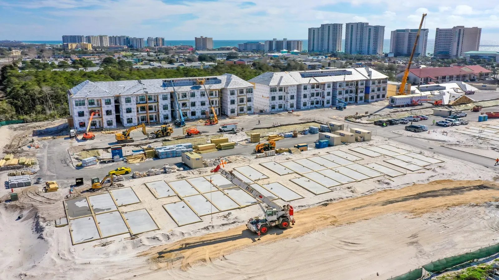
When an owner or project manager can’t be on site, a few close-up photos may leave them wondering where the work is happening or how it fits into the rest of the build. Aerial views bring the site together in one image, showing buildings, access roads, staging areas and surrounding work. Closer views then let your team focus on a particular roof, elevation or section of the project without losing that context.
Our commercial construction progress photography gives your team useful images for owner updates, contractor discussions and project meetings. You can show the latest activity, compare it with an earlier visit and keep a dated record as the job moves forward. If you also want to share the build publicly, we can plan photos or video for your website and social media alongside the construction documentation.
We build the coverage around the size of your site and what you need to show. A single building may need a few consistent exterior views, while a larger development may need a wider overview and separate coverage of each phase. Your quote will identify the photos, video and editing included, so you can choose the right combination for the project.
Site-wide overviews and closer building or work-area views, including the milestones you want to document as construction moves ahead.
Footage that shows the layout and activity across the site. Edited project updates or marketing videos can be included when requested.
Images organized by visit, with capture dates and building or work-area identification as arranged, making earlier views easier to find.
The photos give project managers material to use in their own reports and presentations. If your team needs particular file formats or an edited presentation, we can discuss that before capture and include any additional work in the quote.
Our photography
These photographs are from different construction settings. A wider site view explains access and active work areas; a closer building view helps focus the discussion on visible progress.
For recurring progress updates, we identify repeat viewpoints and the areas that matter most to your team. That might include a wide view of the whole development, each side of a building and closer coverage of active work. Keeping those views consistent makes before-and-after comparisons more useful than a new set of unrelated angles each time. We repeat positions where practical and adjust as buildings, cranes and activity change the available view.
Weekly progress coverage can help during a busy phase, while biweekly or monthly updates may be enough when changes are less frequent. Milestone documentation is another option: a visit can record site preparation, framing, roofing or exterior completion without a fixed schedule. We can also shift attention to a new building or phase as the project develops. The goal is a useful record of the work, with visits timed to the changes your team wants to see.
We cover construction projects across Bay, Walton, Okaloosa and Gulf counties, including Panama City Beach, Destin, 30A and Freeport. Before the first visit, we review the location and flight requirements and coordinate access with your site contact. Active work, crane locations and restricted areas help determine where we can safely capture the views you need.
To request a quote, send the address, current stage, preferred visit schedule and any deadline for the photos. A site plan or marked-up image is helpful if there are several buildings or specific areas to cover. Weather and airspace restrictions can affect scheduling, so let us know about important reporting dates early.
See our service areasIf your team needs more than photos and video, drone mapping can provide an overhead site map, a 3D model or stockpile volume estimates. Ground-based 360 construction walkthroughs can document accessible interior areas so you can revisit rooms and construction stages remotely. These are separate services with their own capture and delivery requirements, and we can discuss them alongside your progress coverage when they would be useful.
Drone mapping and 3D models 360 construction walkthroughsGood to know
Yes. We can begin at the current stage and continue from there. If you have earlier progress images, share them so we can see which views you would like to continue.
Yes. A single visit can document a milestone or provide current photos for a meeting or presentation. You don’t need to commit to a recurring schedule.
No. The images document visible conditions at the time of the visit. They don’t replace a professional inspection or verify workmanship, quantities or completion.
Our home build monitoring service is designed for owners who can’t visit regularly. We can discuss the areas you want to see and the updates that would help you follow your home’s progress.
Request this service
Tell us where you’re building and what you’d like to capture. Whether you need one visit or continued coverage, we’ll help you put together a plan for the project.
Request a construction quoteConstruction Progress & Drone Photography on Florida’s Emerald Coast.
Based in Panama City Beach, serving Bay County · Walton County · Okaloosa County · Gulf County. Farther trips by request.
Project examples
Home build monitoring · Walton County, Florida
See foundation preparation, roof framing and a ground-based interior walkthrough from three visits to a Walton County home under construction.
Read case study ↗Project example · Drone mapping & 3D modeling
Compare an overhead drone map and a textured 3D model of the same multi-building construction site. See what each view helps a project team understand.
Read case study ↗More drone services
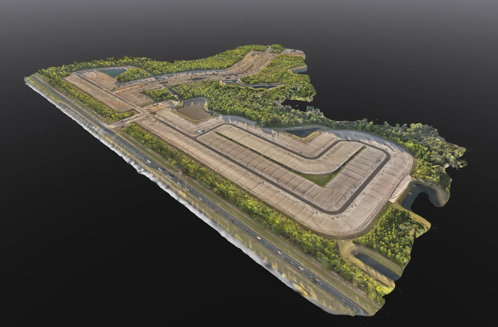
Mapping
Overhead site maps, 3D models and stockpile volume estimates to help you review and document your property.
Explore service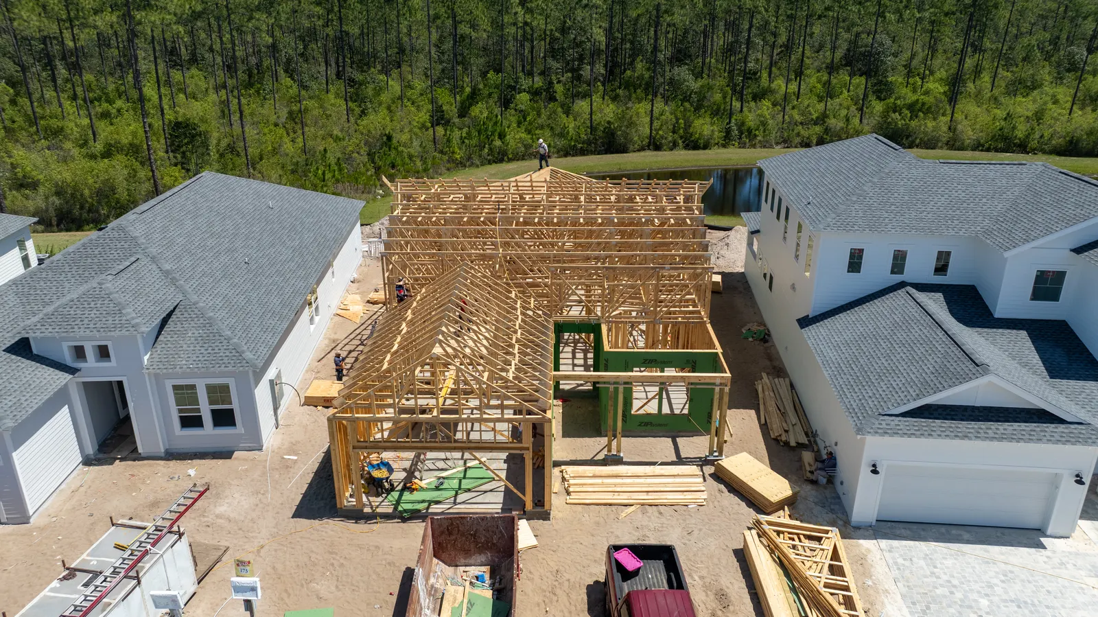
Construction
See dated photos of your home build and discuss progress or concerns with your builder when you cannot visit.
Explore service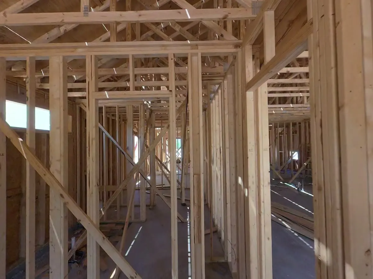
Construction
Revisit accessible rooms and construction stages with a 360° walkthrough captured using a ground-based camera.
Explore service