Emerald Coast Drone Pros and Destin Drone Solutions
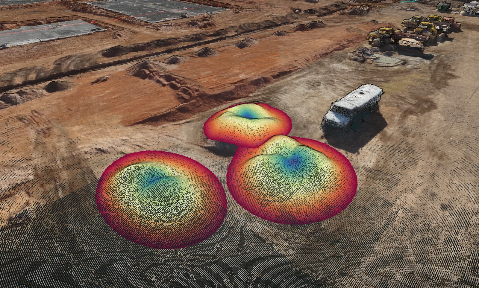
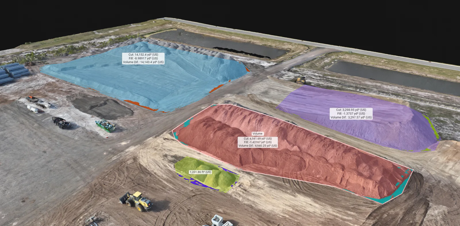
Stockpile model with colored measurement boundaries and displayed volume labels

Stockpiles and surface comparisons

Stockpile volumes & earthwork.

We use drone imagery to estimate stockpile volumes and compare changes in earthwork areas in Panama City Beach and across the Emerald Coast. Results identify the selected area, reference surface, units and assumptions so your team can interpret the estimate.

Based in Panama City Beach · Bay, Walton, Okaloosa & Gulf counties

Overview

A volume calculation you can follow

For a stockpile, drone imagery is processed into a surface that describes the visible material. The volume is calculated between that surface and a defined base within the selected pile boundary. The result depends on all three: the surface, the base and the area included.

For a material yard, the record can support an internal inventory review or help your team discuss how individual piles have changed. An overhead view or model identifies the pile, while the units and base method explain the quantity. Where piles touch or a wall hides an edge, we review whether they can be treated as separate piles.

Why the ground beneath the pile matters

The drone can photograph the outside of a pile, but it cannot see the ground buried underneath. A suitable recorded surface from before the pile was placed may provide a base. In other situations, the calculation relies on a stated assumption about the underlying ground.

A flat base may be a poor match for a sloping yard. Likewise, an outline around the visible material does not tell us everything about a concealed edge. Share any earlier mapping or ground information you have so we can review the available options and explain the basis proposed for your calculation.

Volumetric project work

See the material behind the measurement.

These projects connect selected stockpiles and earthwork regions with the surrounding site and the calculation views.

Materials & quantities

Stockpile mapping & volume analysis

A quantity discussion needs more than a number. The selected pile, its surrounding ground and the reference surface all matter. The paired views show outlined materials within a wider working yard.
Volume regions

Colored regions and displayed volume labels identify selected stockpile areas in the model.

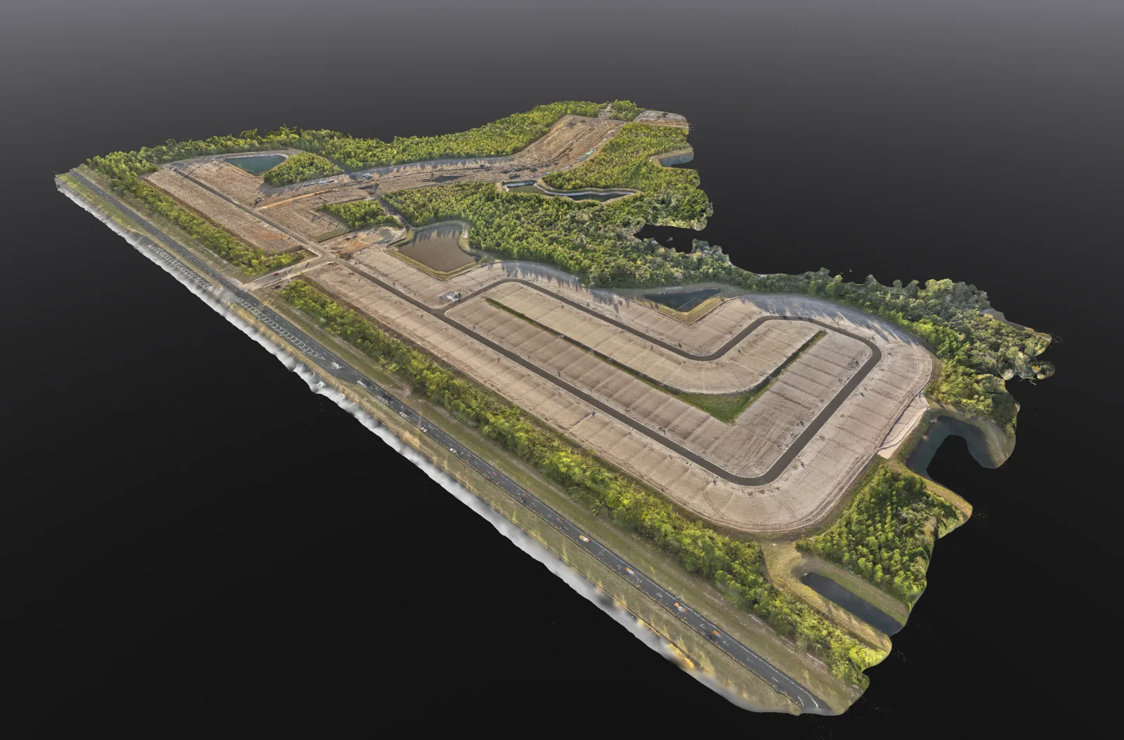
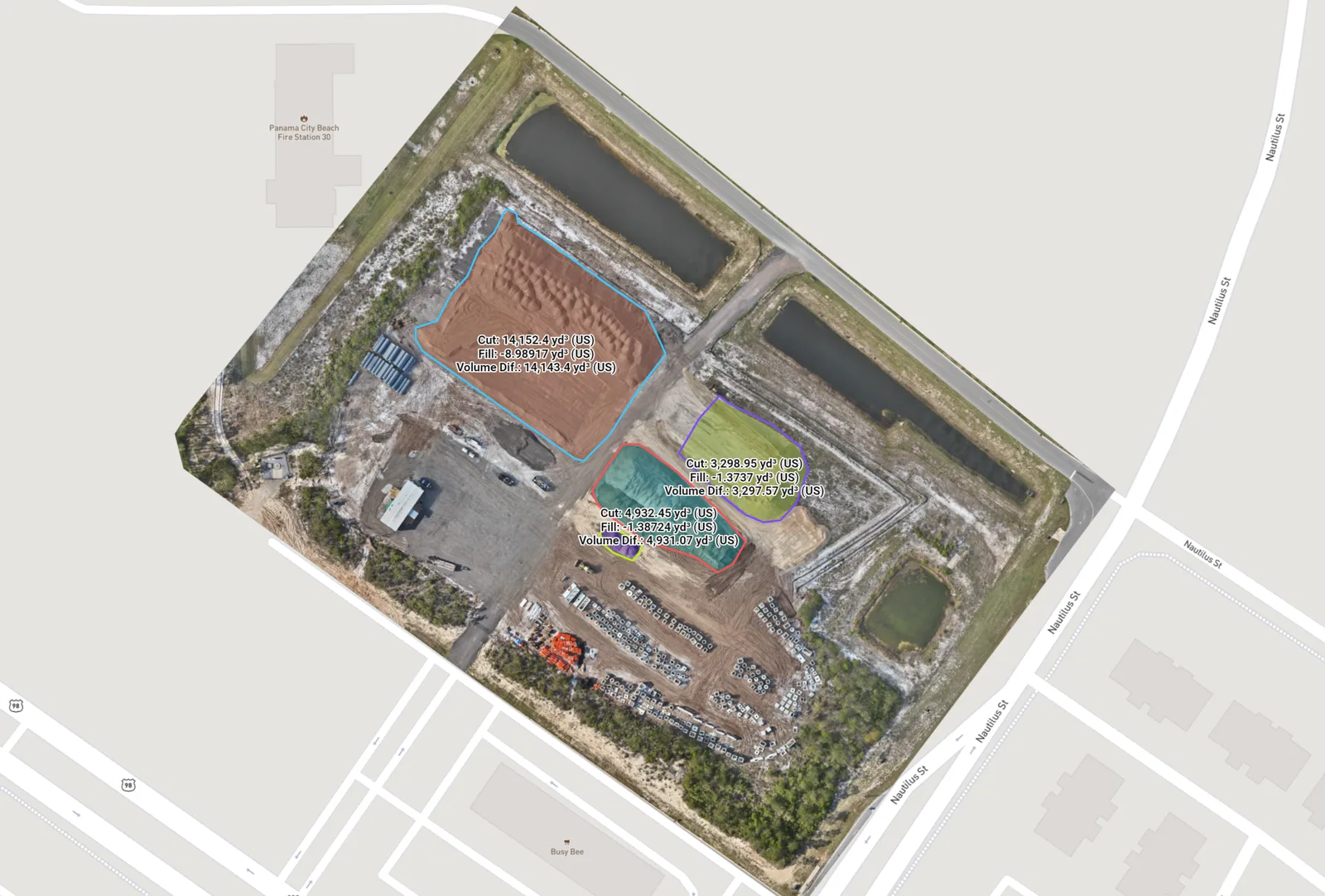
Mapped yard overview

The related overhead view helps locate the piles, access routes and surrounding site features.

What this helps you doLocate the selected piles, see which material regions were measured and discuss quantities with the yard in view.

Technical context

Keep the pile identifier, selected boundary, units and base method with the calculation. Repeat measurements need a consistent basis so a change in the calculation setup is not confused with a change in material.
Earthwork quantities

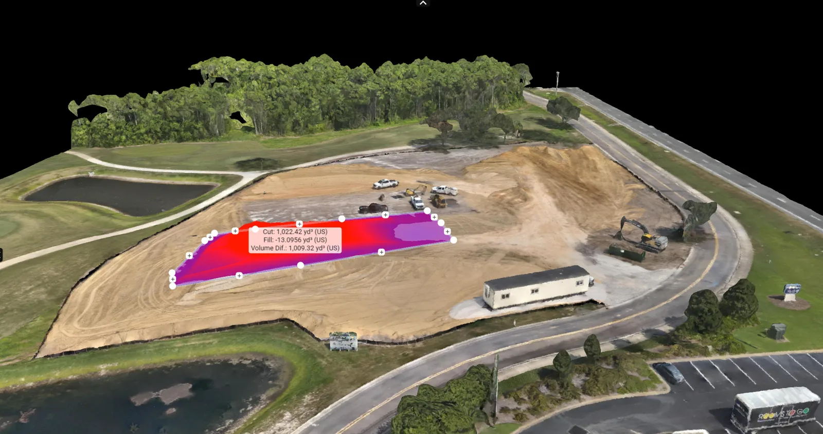
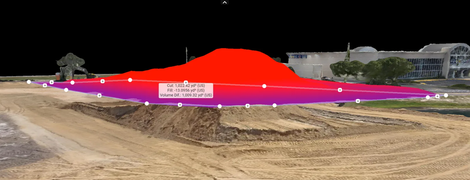
An earthwork region from two viewpoints

A quantity is easier to discuss when the selected region is visible within the site. These related views show the outlined earthwork area from above and from a lower viewpoint.

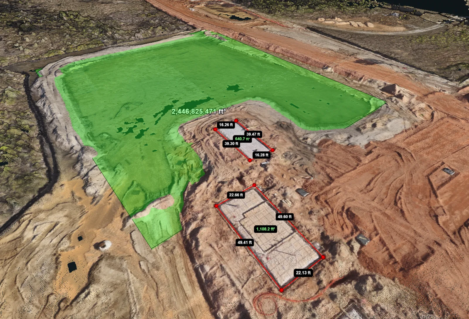
Selected earthwork area

An oblique model shows the outlined region used for the displayed calculation.

Lower viewpoint

A lower viewpoint shows the colored calculation region in relation to the visible site surface.

What this helps you doSee the extent and shape of the selected earthwork area alongside its displayed calculation.

Technical context

The chosen boundary and reference surface affect the quantity. Agree the base method, units and validation requirements before comparing this kind of result with another measurement.

Surface reconstruction

Measured regions and a point-cloud view

These construction processing views show outlined measurement areas and reconstructed points. Keeping the selected regions visible makes it easier to discuss what is included in the analysis.

Selected surface and measurements

A selected surface region is shown with measurement annotations on the reconstruction.

Point-cloud view

A point-cloud view shows material surfaces and selected regions within the construction site.

What this helps you doReview selected surface regions and see the reconstructed points behind the model representation.

Technical context

A point cloud represents the reconstructed surface as individual points. Review its coverage and visible detail alongside the measurement region; display colors alone do not establish a material classification or thermal reading.

Need a similar view of your site? Send the location and what you need to understand.

Discuss mapping for your site

Follow changes between surfaces

For earthwork documentation, the question may be how a selected area changed between two visits. A cut-and-fill surface comparison may instead involve an existing surface and a suitable supplied reference. These are different comparisons, and the required inputs should be clear from the start.

The surfaces need compatible units and reference information. An alignment offset can look like a change in ground level, even where no material has moved. We review the available inputs and the checks needed before agreeing to a comparison. If repeat visits are planned, consistent coverage and reference information help make the later results useful.

Keep the result with its supporting information

A useful volume record allows someone else to identify the material and understand how it was calculated. We agree which calculated quantities, views and requested file exports are included before booking.

The proposed volume record will identify:

The selected area

A pile or work-area identifier and a view showing its boundary and any exclusions.

The reference surface

The source of the base or comparison surface, including any modeling assumption.

The quantity and context

The calculated volume, units, capture date and notes needed to interpret the result.

Make recurring comparisons easier to understand

If you need to review the same yard or work area again, identify the piles and coverage you want to follow. Consistent names, capture dates and units make the records easier to compare. Changes to a pile boundary or reference base should be explained alongside the new result.

Tell us if material is being moved during the planned visit or if some areas are temporarily inaccessible. Site activity and obstructions can affect the capture. A repeat visit is most useful when it records the intended area under conditions that support the comparison.

What to send with your inquiry

Send the site location, the piles or earthwork areas of interest, and how you intend to use the quantities. Include any earlier surfaces, reference drawings or reporting requirements, along with the site contact and timing. If the result will be reviewed by another professional, their requirements belong in the brief.

We are based in Panama City Beach and cover Bay, Walton, Okaloosa and Gulf counties. For a general picture of site layout rather than a quantity calculation, orthomosaic mapping may be the better starting point.

Orthomosaic mapping Compare mapping services

Good to know

Questions about this service

Does a volume tell me the material’s weight?

No. Volume describes the space occupied, usually in cubic units. Weight depends on material density and other factors that imagery alone does not establish.

Why can two stockpile calculations show different quantities?

The material may have changed, or the calculations may use different dates, pile boundaries, base surfaces or units. Check those inputs before treating the difference as material added or removed. The number of decimal places is not a statement of accuracy.

Can these quantities be used for payment or certified survey work?

Our drone volume service does not provide certified survey quantities, payment verification or engineering acceptance. Tell us before booking if the result has a contractual or regulated use so the required professional work and validation can be addressed.

Can you calculate every pile on a site?

Coverage depends on visibility, access and whether the pile boundaries and base can be established adequately. Send the location and areas you want included so we can review the request.

Request this service

Start with the pile or area you need to measure

Send the location, intended use and any reference information. We will review the inputs, capture requirements and proposed quantity record with you.

Request a quote

Drone Volumetrics on Florida’s Emerald Coast.
Based in Panama City Beach, serving Bay County · Walton County · Okaloosa County · Gulf County. Farther trips by request.

Explore service areas

Privacy settings

Choose which external features may load. You can browse services and send a request with a typed address using essential features alone.

Essential site featuresSite security, request delivery and your privacy preference. No advertising or analytics tracker.
Always on

Turning off content already loaded reloads this page to close its connection. Copy any unfinished request details before saving that change.

Your choice is stored on this browser for up to 180 days. Cookie details · Privacy notice