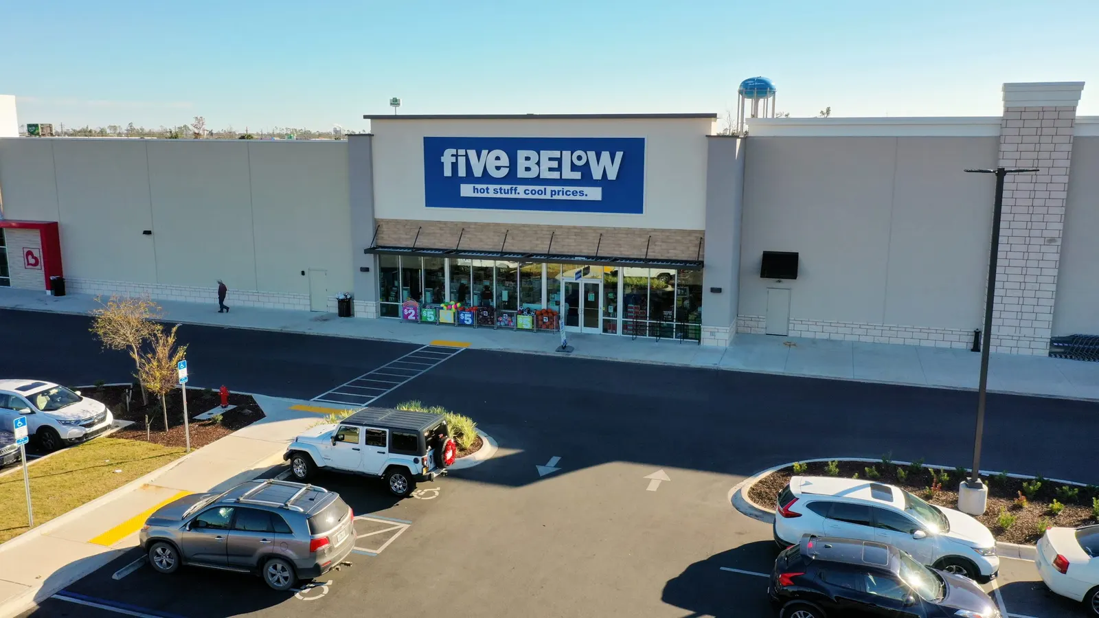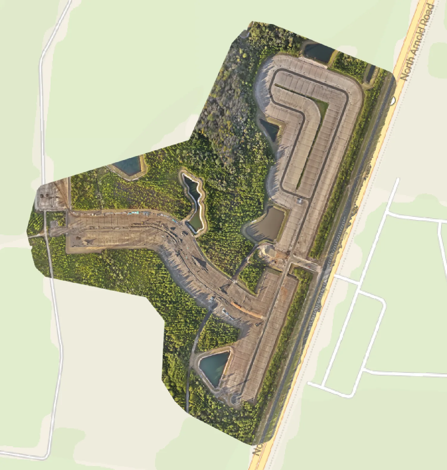
Emerald Coast Drone Pros and Destin Drone Solutions
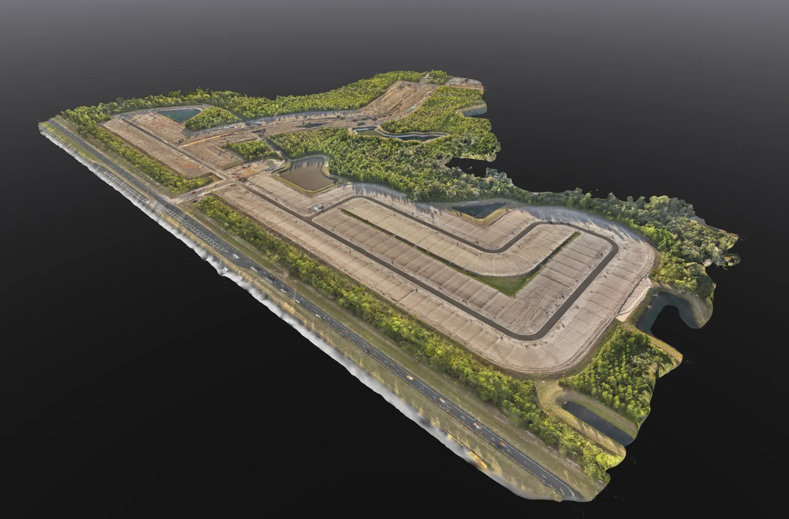
Overhead mapped view of the subdivision and its surrounding context

Mapping and site documentation

Orthomosaic mapping.

Emerald Coast Drone Pros creates orthomosaic maps in Panama City Beach and across the Emerald Coast. These continuous overhead images bring visible site conditions into one view, helping property owners and project teams follow the layout, compare reference information and share a clearer picture of the site.

Based in Panama City Beach · Bay, Walton, Okaloosa & Gulf counties

Overview

When the available aerial map is out of date

A property can change long before the next online map update. Clearing, new roads, building work and changes to site access may be missing from the image your team is using. A dated orthomosaic gives the conversation a current starting point.

Instead of switching between separate photographs, you can follow the property from one area to the next. That is useful during a project meeting, when introducing a site to someone working remotely, or when identifying the entrance, building or open area you want to discuss.

How an orthomosaic is made

We capture overlapping aerial photographs and process them into a continuous overhead image. The processing corrects for camera perspective and the modeled surface, bringing the separate views together. This is different from choosing a single wide photograph or simply placing photos side by side.

The capture is planned around the requested area and the visible detail you need. We review the assembled image for gaps, seams and distorted features. Selected oblique photographs can add context where an overhead view alone makes a building, slope or other feature difficult to understand.

Orthomosaic project work

From the whole site to the detail that matters.

Overhead imagery brings roads, buildings and work areas into one reference. These projects show wider coverage alongside a closer view or drawing.

Property & plan context

Neighborhood mapping with a drawing reference

A large property needs an overview, but a project discussion often moves quickly to an individual lot or road. These views connect the wider captured neighborhood with a closer reference-plan example.
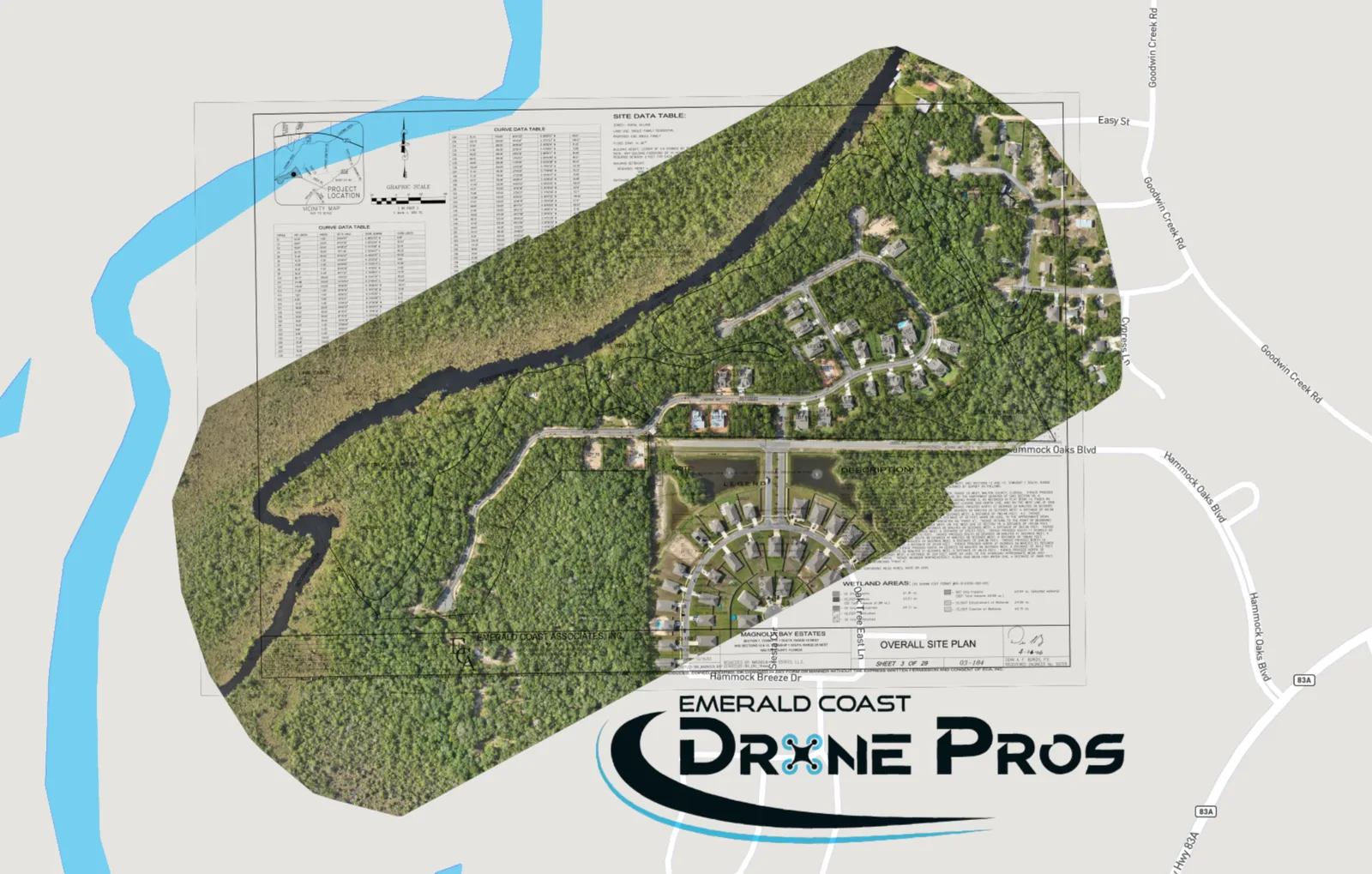
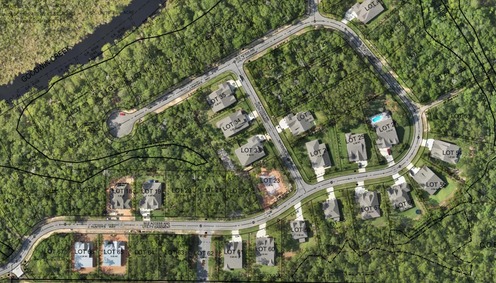
Wider mapped context

The captured neighborhood is shown with wider reference-plan context.

Closer plan reference

Overhead imagery and a reference drawing are displayed together around roads and lots.

What this helps you doFind a road or lot in the wider neighborhood, then bring the conversation down to the area that needs attention.

Technical context

A drawing overlay can support a visual discussion. Its appearance alone does not verify the drawing alignment, establish legal lot lines or certify construction against the plans.
Site coordination

Building-pad imagery alongside a site drawing

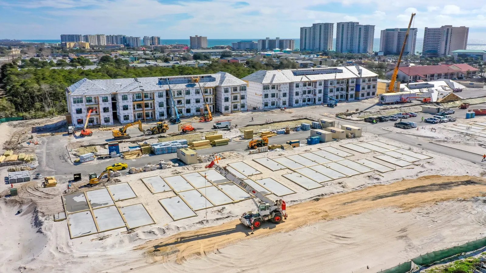
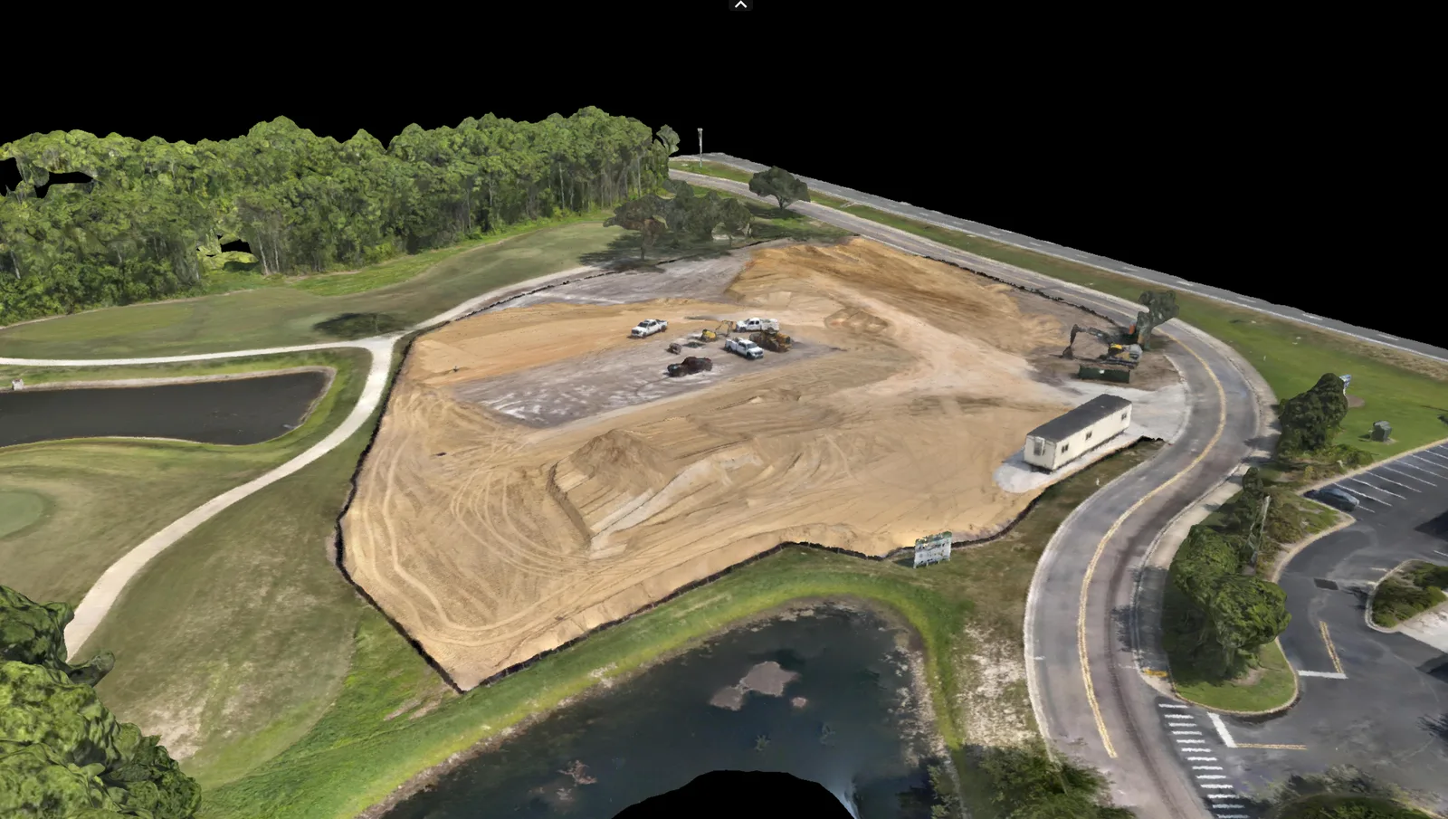
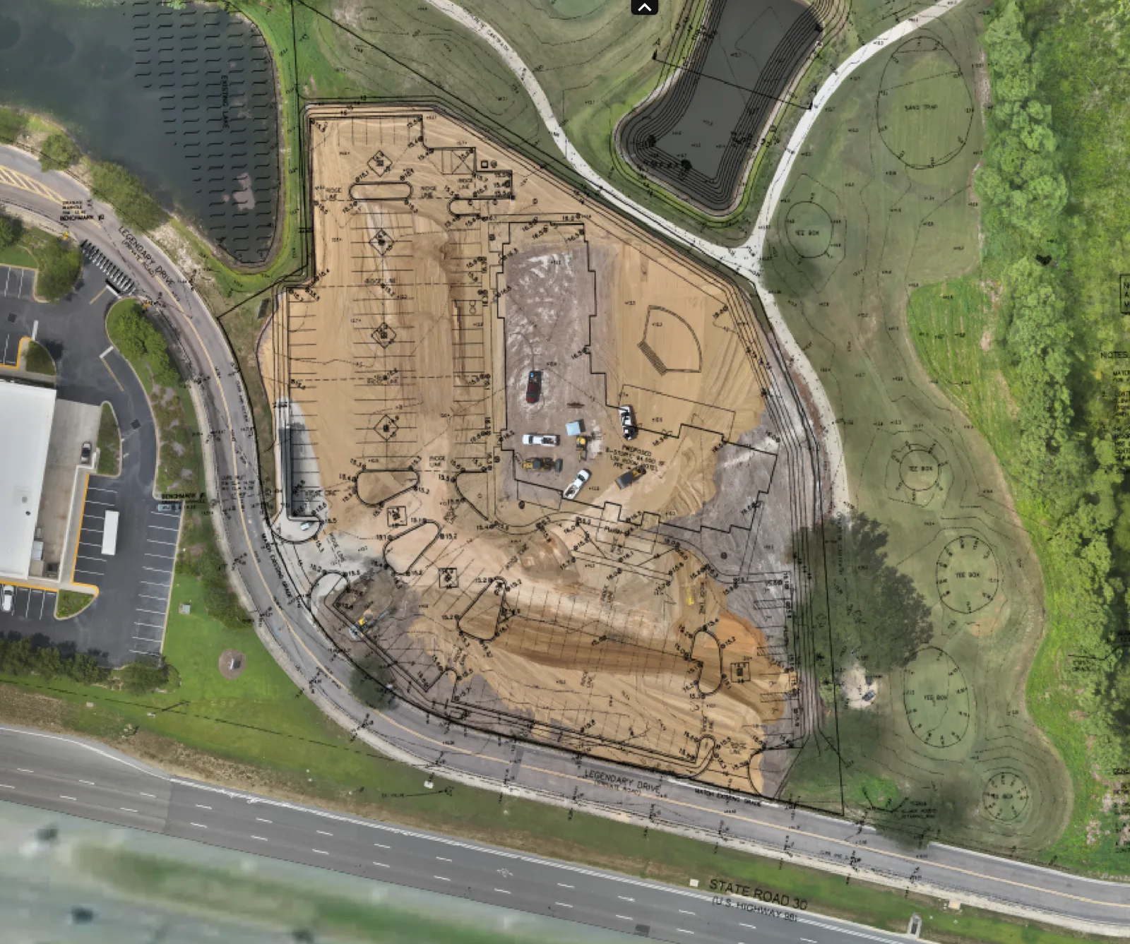
Project teams need to discuss the pad, access and surrounding features using a common reference. This related set includes an unannotated model view and a reference drawing displayed with site imagery.

Visible site conditions

The model shows the pad, access road, adjacent building and nearby water feature.

Drawing reference

A reference drawing is displayed over mapped site imagery around the pad.

What this helps you doReview the visible pad, access and nearby features while referring to the same area on the drawing.

Technical context

The example demonstrates visual coordination between captured conditions and a drawing. It does not demonstrate engineered BIM authoring, survey registration or certified design-conformance checking.

Construction mapping

Foundation-stage detail and footprint imagery

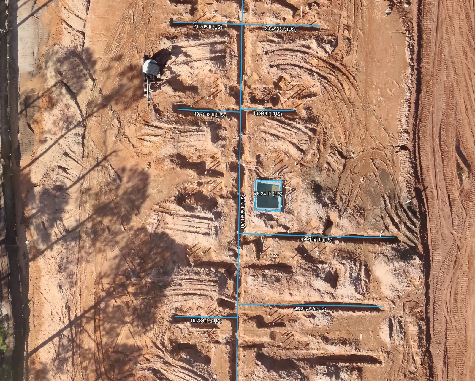
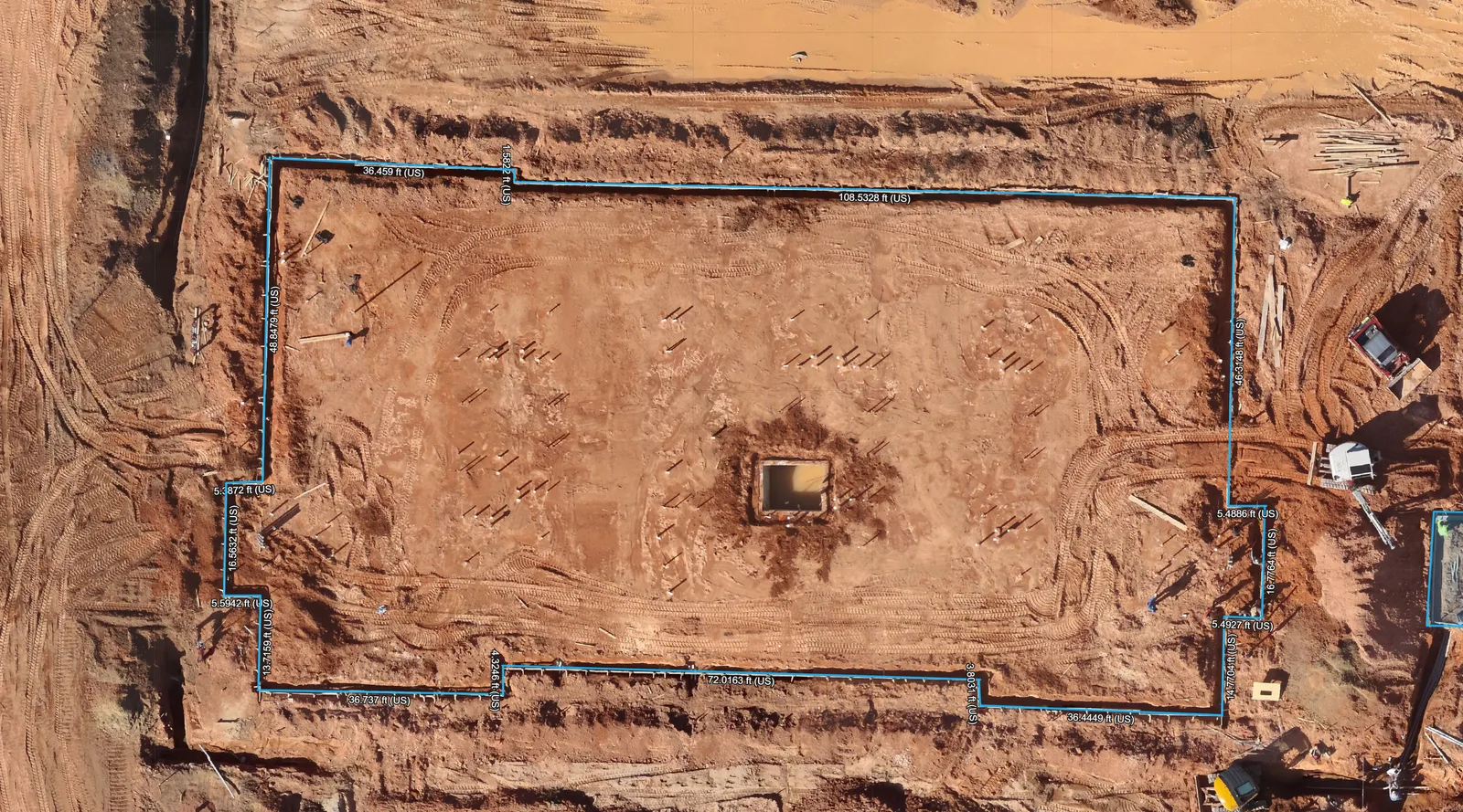
An annotated overhead detail and a closer outlined footprint help focus the discussion on selected construction features. These examples show the different kinds of visible detail that can be retained in the site record.

Annotated construction detail

An overhead construction detail includes linear distance and area annotations.

Closer footprint view

A closer overhead view shows one selected footprint and the surrounding visible ground.

What this helps you doLocate the area being discussed and look more closely at visible foundation-stage work in its surroundings.

Technical context

The outlined features identify areas in the source example. They do not certify the footprint position, dimensions, hidden work or conformance to structural drawings.

Need a similar view of your site? Send the location and what you need to understand.

Discuss mapping for your site

Review current imagery alongside your plans

A site plan is often easier to explain when people can also see the current property. We can discuss a visual overlay of a supplied drawing or imagery presented alongside the original plan. This can help a team locate phases, roads and work areas without everyone needing to know the property already.

Send the drawing and explain what the comparison needs to show. An illustrative overlay and a measurement-dependent comparison need different preparation. If your team needs the image to align with existing project data, include the coordinate reference system, units and other requirements before the flight.

Choose the files your team will use

Some customers need an image they can open and share during a meeting. Others need georeferenced imagery for a GIS or another mapping application. Tell us how the map will be used so the delivery matches that need.

If your team has requested a GeoTIFF or another particular file type, include that in your inquiry. A georeferenced image carries location information for compatible mapping software; a viewing image is intended for straightforward visual review. We confirm the formats, reference information and delivery method before booking, and identify the capture date, coverage and important gaps.

Record the next stage of the site

Repeat orthomosaic mapping can show how visible site conditions change as construction or other work progresses. Keeping a consistent coverage area makes it easier to review new access routes, changes in layout and work completed between visits.

For a fuller progress record, mapping can be paired with aerial photographs of the buildings and work areas you want to follow. If you need volume comparisons rather than a visual before-and-after record, we can discuss the additional surface information that requires.

Construction progress photography Stockpile volumes and earthwork

Planning an orthomosaic mapping visit

Send the site address or a location pin, the approximate area and the purpose of the map. A marked-up image is useful for showing the coverage you want. Include a site contact, relevant access information and any drawings or file requirements.

We are based in Panama City Beach and provide aerial mapping across Bay, Walton, Okaloosa and Gulf counties. We review the location, flight requirements and requested coverage before arranging the visit. Important deadlines are worth mentioning early, particularly on an active site where access and conditions may change.

Compare all mapping services

Good to know

Questions about this service

Can you collect the same area again later?

Yes. Repeat capture can document visible change at useful stages. Let us know at the first visit if you expect to compare later maps so we can plan consistent coverage.

Does an orthomosaic show legal property lines or guaranteed measurements?

An orthomosaic does not establish legal property boundaries. It can support measurement only when the capture, reference information and checks are suitable for that use; sharp imagery alone does not prove positional accuracy. Tell us about any required measurements before booking. Licensed survey or engineering work remains separate.

Will everything on the site be visible?

No. Trees, roofs and equipment can conceal ground or other features. Water, reflective surfaces and moving objects can also be difficult to reconstruct. Tell us about the specific areas you need to see.

Would a 3D model be more useful?

An orthomosaic is best for following the layout from above. A 3D model adds views of visible surface shape from different angles. If slopes or building form are important to your discussion, a model may be a useful addition.

Request this service

Get a current view of your site

Send the location, coverage area and how you plan to use the imagery. Include any drawing or file requirements so we can prepare a suitable quote.

Request a quote

Orthomosaic Mapping on Florida’s Emerald Coast.
Based in Panama City Beach, serving Bay County · Walton County · Okaloosa County · Gulf County. Farther trips by request.

Explore service areas

Privacy settings

Choose which external features may load. You can browse services and send a request with a typed address using essential features alone.

Essential site featuresSite security, request delivery and your privacy preference. No advertising or analytics tracker.
Always on

Turning off content already loaded reloads this page to close its connection. Copy any unfinished request details before saving that change.

Your choice is stored on this browser for up to 180 days. Cookie details · Privacy notice