Emerald Coast Drone Pros and Destin Drone Solutions
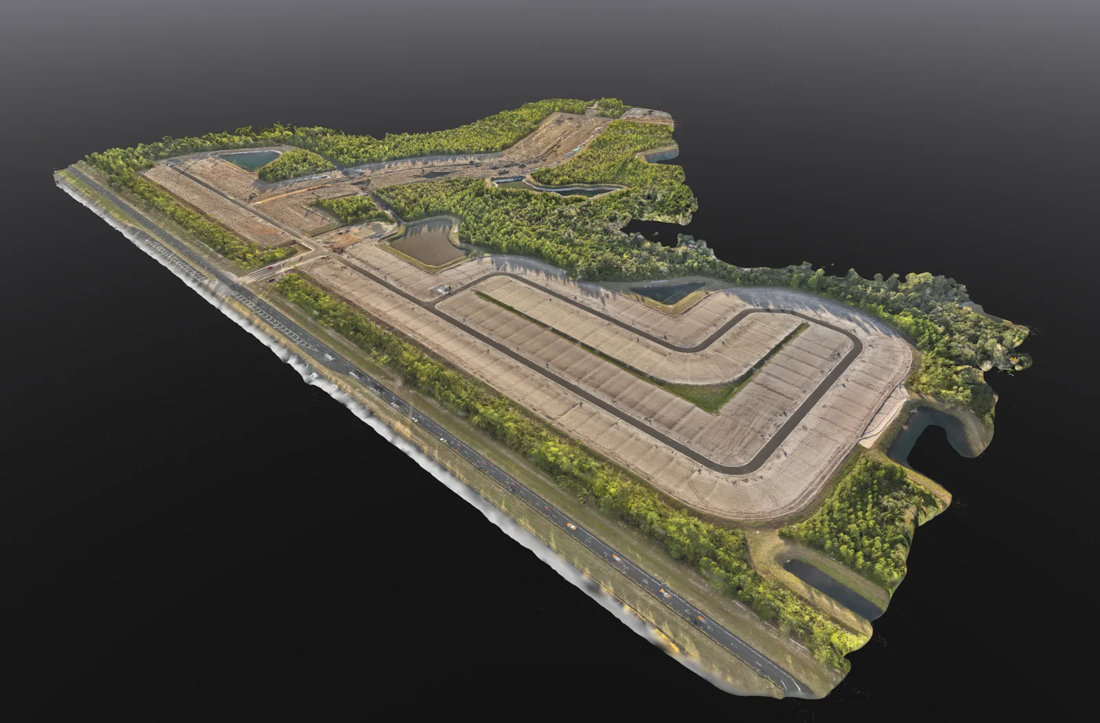
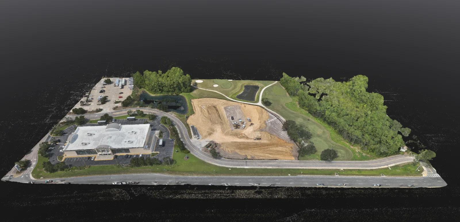
Reconstructed commercial site showing a building, cleared pad, roads and water feature

Photogrammetry and project context

3D site models & point clouds.

Emerald Coast Drone Pros creates photogrammetric 3D site models in Panama City Beach and across the Emerald Coast. Overlapping photographs become point clouds and textured surfaces that help explain slopes, structures and changes in height, with the views and handoff planned around your project's use.

Based in Panama City Beach · Bay, Walton, Okaloosa & Gulf counties

Overview

Give your team a better sense of the site

A 3D model helps people connect the features they can see in individual photographs. They can understand how a building sits within the property, how a road follows the visible ground, or how different parts of a development relate to one another. This is especially useful when someone needs to review the site remotely.

For project discussions and presentations, selected model views can show the same site from above and at an angle. If your main need is a simple overhead layout, an orthomosaic may be enough. We will help you decide whether the extra perspective of a model adds useful information.

Explore orthomosaic mapping

A textured model and a point cloud serve different needs

A textured 3D mesh gives reconstructed surfaces a photographic appearance. It makes buildings and ground features easy to recognize and can help explain the overall form of the site. A point cloud represents the reconstruction as many individual points in three dimensions, offering a different way to work with the visible geometry.

For a presentation, a textured model or selected views may be the clearest choice. A team doing further processing may instead request a point cloud or mesh export for its own software. Tell us who will use the model, what they need to review and which software or file format they require. We can then agree the coverage and export before capture.

3D modeling project work

Buildings and construction sites, reconstructed in 3D.

Compare the model with another view of the same project to understand the visible building form, work areas and site layout.

Building reconstruction

Commercial building & site modeling

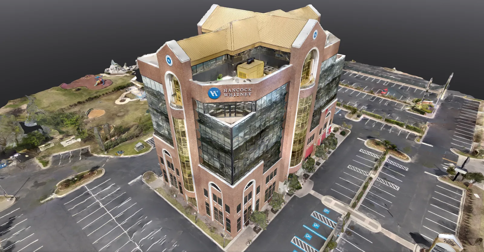
A building model needs more than a roof view. Alternate viewpoints help a reviewer understand the visible facades, roof form and relationship to the surrounding ground.
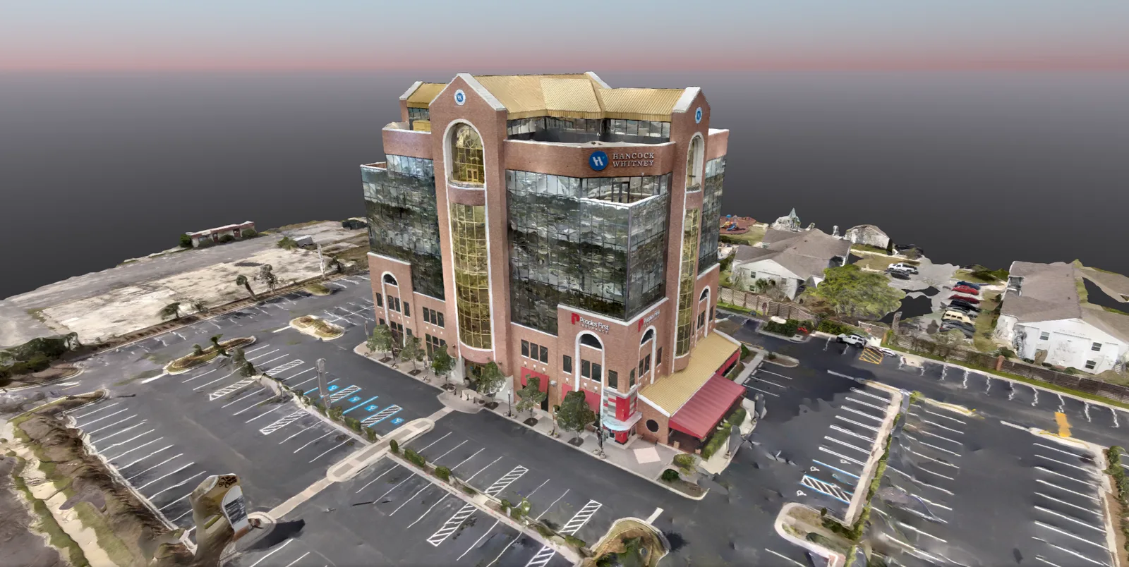
Building and site context

A reconstructed commercial building is shown with its parking area and surroundings.

Roof and facade viewpoint

Another view of the same recognizable building shows its roof and alternate facades.

What this helps you doReview the roof, visible facades and parking layout from complementary viewpoints of the same building.

Technical context

Reconstruction quality can vary around windows, reflective surfaces, fine edges and occluded areas. Visible signage is part of the captured scene and does not imply client endorsement.
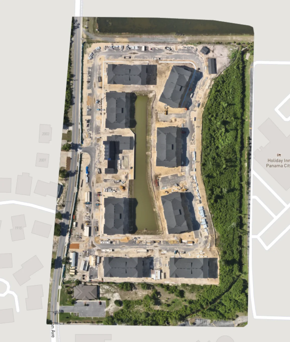
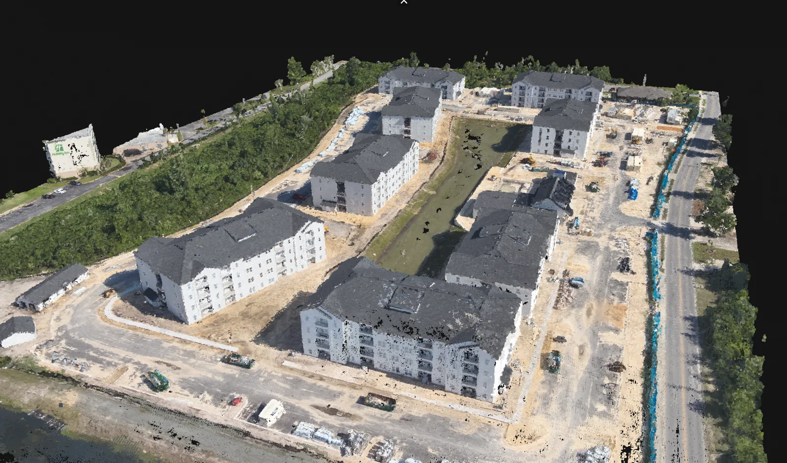
Construction reality capture

A multi-building construction site in 2D and 3D

The overhead map brings the buildings, internal roads and work areas into one view. The oblique reconstruction shows the form of those same buildings and how they sit within the construction site.

Overhead site record

Mapped roofs, buildings, roads and active work areas in one overhead view.

Oblique reconstruction

An alternate model view shows the visible buildings and site layout together.

What this helps you doOrient people who cannot visit the site and help them relate individual buildings to the wider construction area.

Technical context

Use the mapped view to orient the discussion and the reconstruction to explain visible context. Conditions hidden behind surfaces or inside buildings are outside what these images show.

Construction reality capture

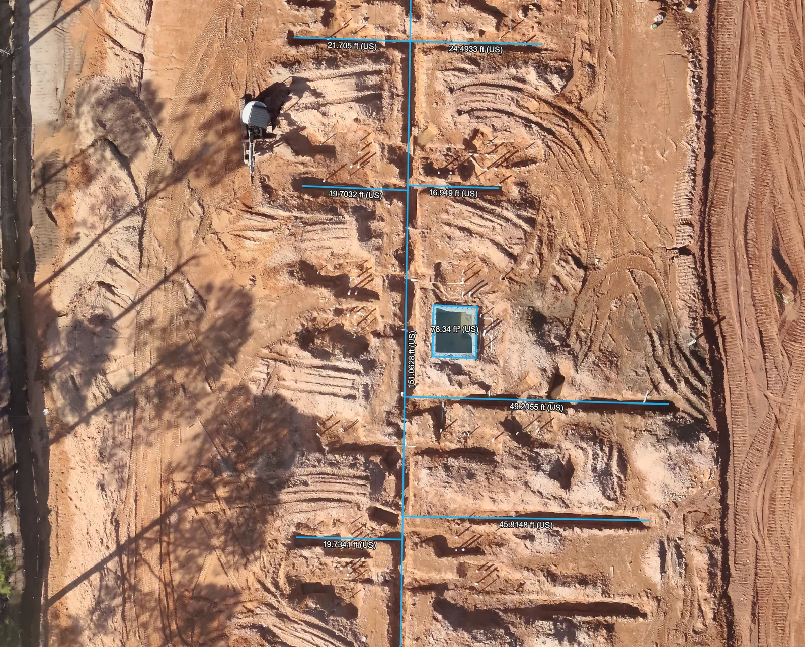
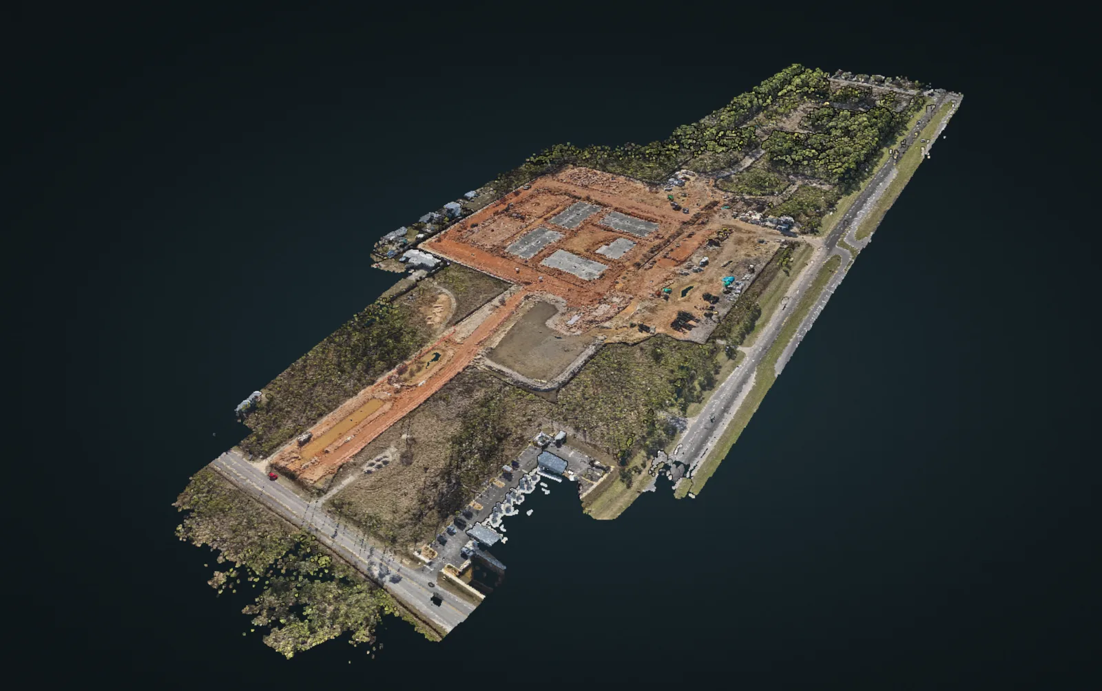
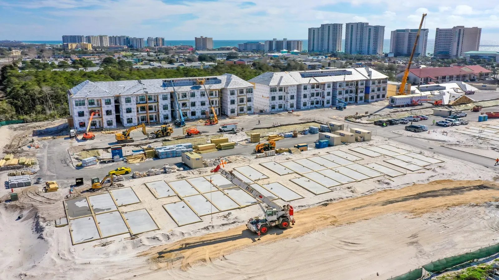
Foundation detail within the wider 3D site

An annotated overhead detail and a whole-site reconstruction show different scales of the construction work. The model adds context around visible work areas, access and the surrounding site.

Annotated overhead detail

Linear distance and area annotations are visible in a selected construction detail.

Whole-site reconstruction

A textured model places the foundation-stage work within the surrounding site.

What this helps you doConnect a closer construction detail to its position in the whole-site reconstruction.

Technical context

Compare the products for gaps, obstructed areas and unclear edges before choosing how to use them. A useful visual model still needs an appropriate validation basis for measurement work.

Need a similar view of your site? Send the location and what you need to understand.

Discuss mapping for your site

Built from overlapping aerial photographs

Photogrammetry finds shared features in photographs taken from different positions and uses them to reconstruct visible surfaces. Overhead images help cover roofs and upward-facing ground. Suitable angled views add information about building sides and changes in surface shape.

A point cloud and a mesh should be inspected differently. With points, look at coverage, isolated noise and areas where the surface is poorly represented. With a mesh, look for holes, bridging between unrelated features and distorted edges. Texture can make a model easy to recognize while hiding those geometric problems, so a polished appearance is only one part of review.

Plan the model around your next step

The proposed delivery can include a textured site model, selected views and a point-cloud or mesh export, depending on your request. We agree what is included before booking. For technical files, send the receiving application and requested format. If you need LAS or LAZ point clouds or an OBJ mesh, let us know so we can confirm the export options for your project.

Units, the coordinate reference system and the model origin can matter when combining the result with other project data. If your team has written requirements, share them directly. We can review those requirements before collecting the imagery instead of leaving compatibility questions until delivery.

Add the context your project needs

A model can sit alongside an overhead map or dated construction photographs. The map helps viewers locate a work area, the model helps explain its shape, and photographs can give a closer look at a particular feature. You can request the combination that is useful rather than ordering every output.

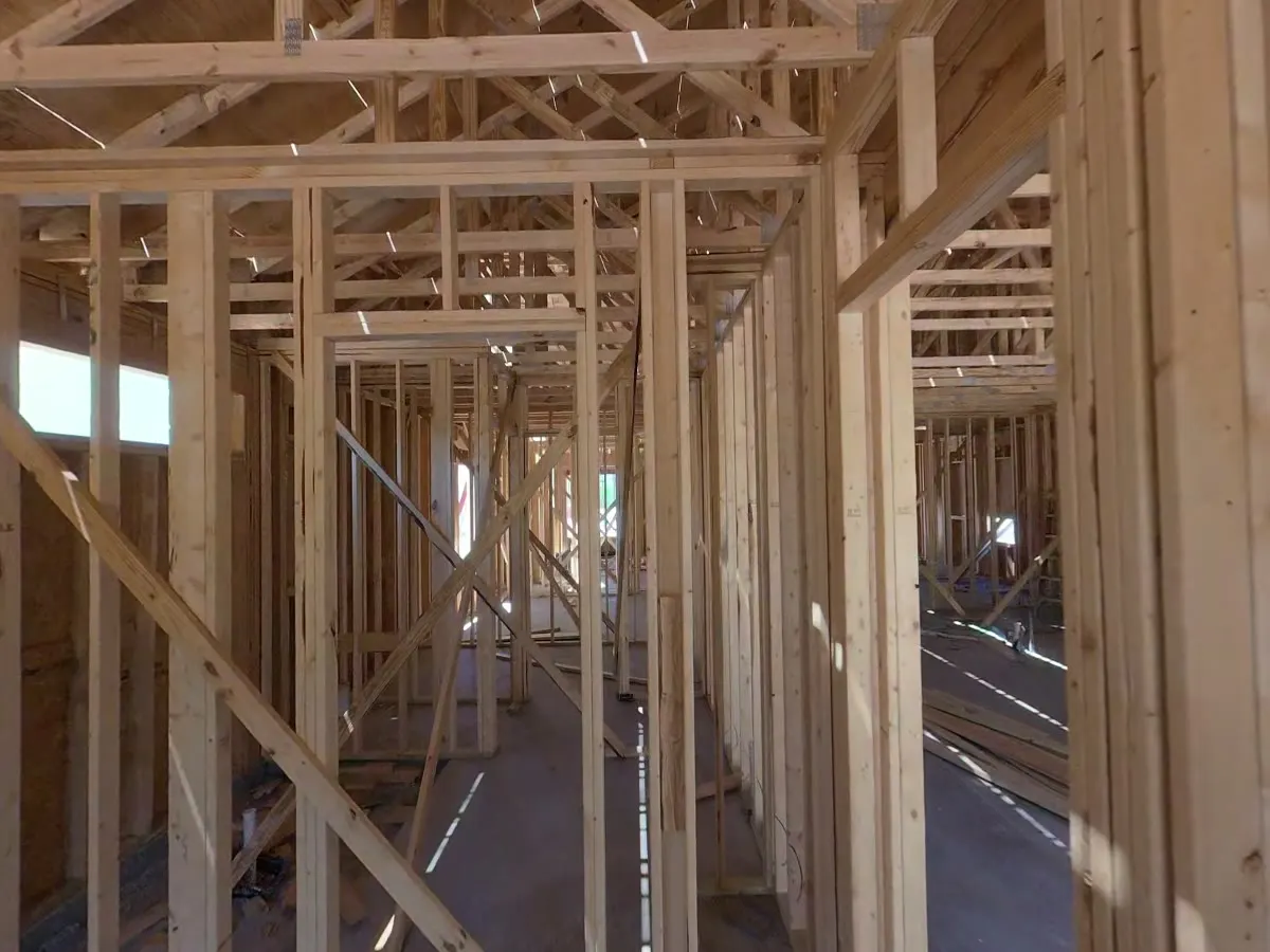
For interior construction records, a ground-based 360° walkthrough provides a different perspective. Aerial modeling shows the surfaces visible from outside; it does not document the rooms or concealed work inside a building.

Construction progress photography Ground-based 360° construction walkthroughs

Tell us which features need attention

Send the location, approximate area and a short description of what you want the model to show. Include priority buildings or ground features, the intended audience and any software or file requirements. We will review access, visibility and flight requirements before arranging the capture.

Based in Panama City Beach, we provide 3D site modeling across Bay, Walton, Okaloosa and Gulf counties. If you are not sure whether your site is suitable, send a location reference and we can start there.

Good to know

Questions about this service

Can a model show areas under trees or behind buildings?

Only surfaces visible in suitable photographs can be reconstructed reliably. Dense vegetation, reflective windows, fine edges and obstructed areas may produce gaps or distorted geometry. Important coverage limits should remain clear in the finished model.

Is a point cloud the same as a laser scan?

No. Our photogrammetric point clouds are reconstructed from photographs. A point cloud describes the form of the output, not how it was captured.

Can I use the model for engineering or survey measurements?

A visual model is not a certified survey or engineering deliverable. Share the exact requirements before booking if measurements, alignment or elevations are important. Any such use needs suitable reference information, checks and professional involvement; a realistic-looking model alone does not establish accuracy.

Do I need specialist software to view the result?

Not necessarily. Selected model views can be delivered for straightforward review without specialist 3D software. Working directly with a model or point cloud may require a compatible viewer or application. We agree the viewing method and files before capture.

Request this service

Show us what your model needs to explain

Send the site location, priority features and intended use. If another team will use the files, include its requirements with your inquiry.

Request a quote

3D Site Models on Florida’s Emerald Coast.
Based in Panama City Beach, serving Bay County · Walton County · Okaloosa County · Gulf County. Farther trips by request.

Explore service areas

Privacy settings

Choose which external features may load. You can browse services and send a request with a typed address using essential features alone.

Essential site featuresSite security, request delivery and your privacy preference. No advertising or analytics tracker.
Always on

Turning off content already loaded reloads this page to close its connection. Copy any unfinished request details before saving that change.

Your choice is stored on this browser for up to 180 days. Cookie details · Privacy notice