
Project example · Drone mapping & 3D modeling
One construction site, mapped in 2D and 3D
Compare an overhead drone map and a textured 3D model of the same multi-building construction site. See what each view helps a project team understand.
Based in Panama City Beach · Bay, Walton, Okaloosa & Gulf counties
What the project shows
Find the building on the map. See its form in the model.
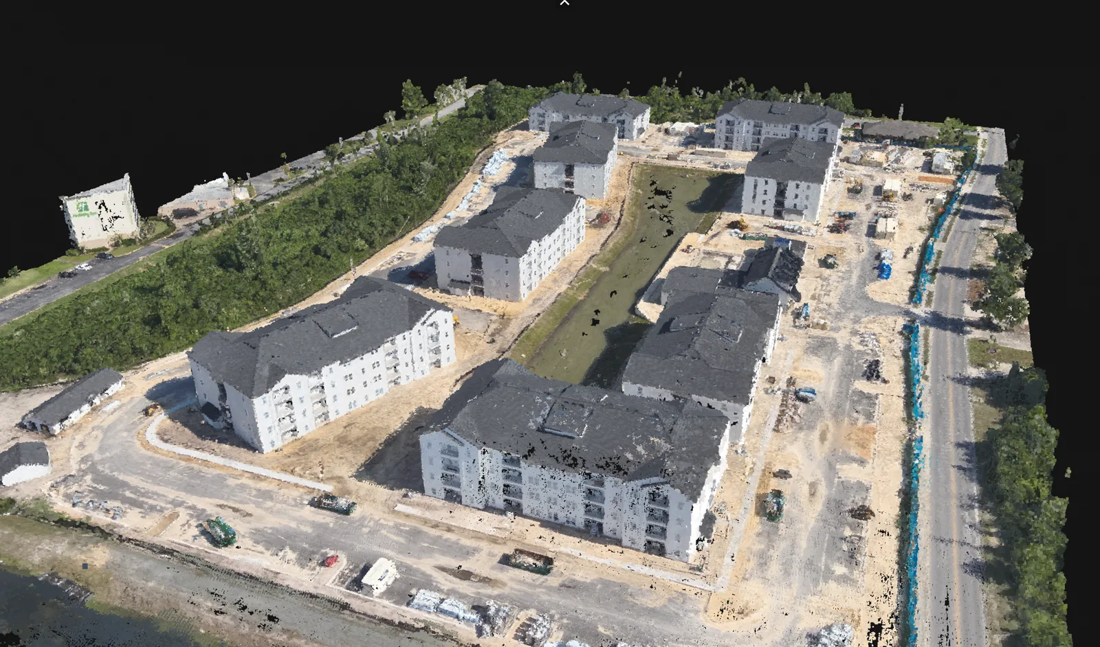
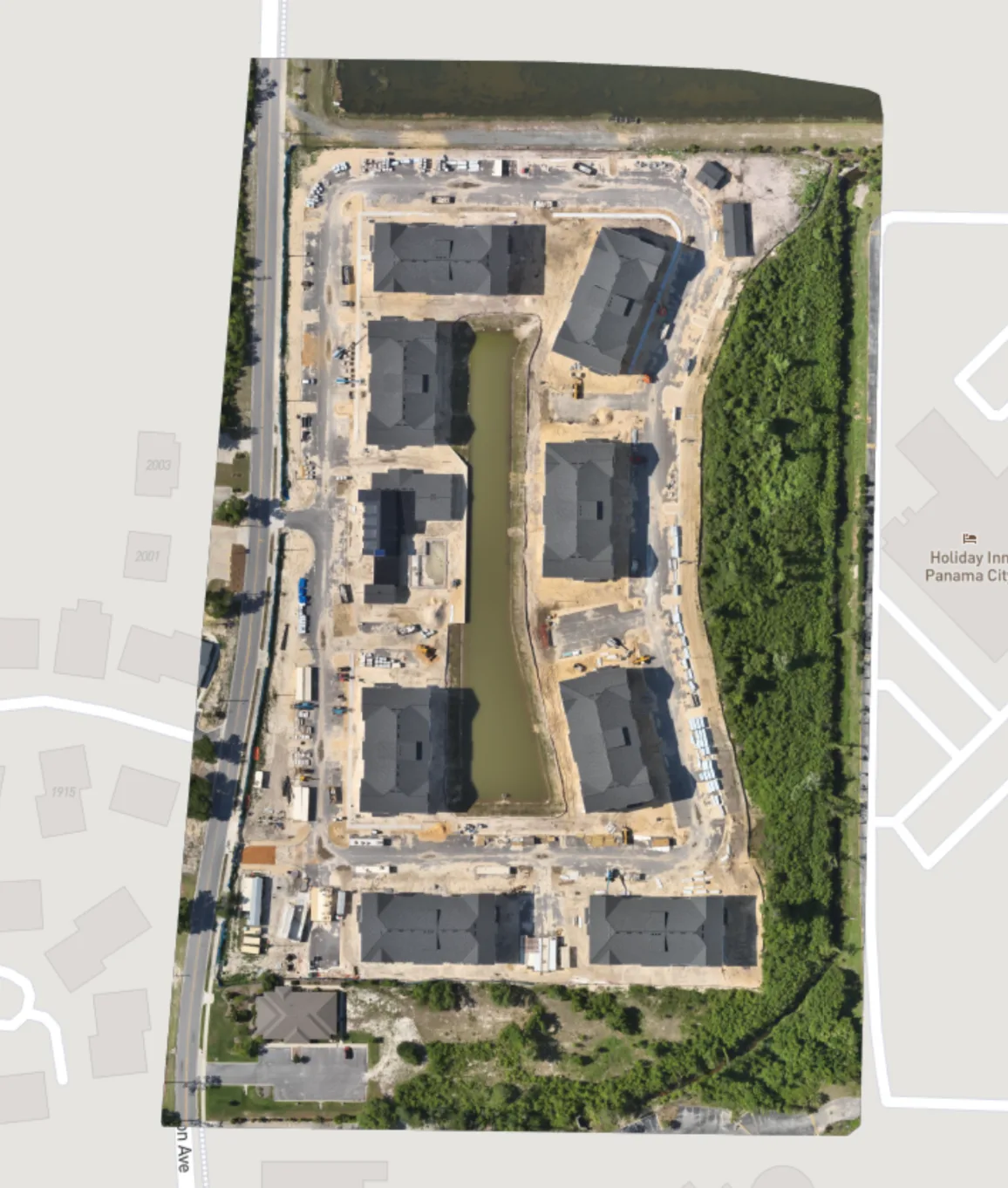
On a site with several buildings, separate aerial photos can make it hard to tell how the buildings and work areas fit together. This project pairs an overhead map with an oblique 3D reconstruction of the same site.
Output 01
Overhead drone map
Output 02
Textured 3D site model
Planning a similar job
Choose the view your team will actually use.
Start with the area your team needs to understand and the decision it needs to make. A map may be enough for an overhead record. A model can add useful context when height and shape matter. These examples show visible surfaces. If your project requires a particular coordinate system, verified accuracy, or a licensed survey, tell us during scoping so the requirements and responsibilities are clear.
Request drone mapping