
Introduction
Definition of Drone Services
Drone services refer to the use of unmanned aerial vehicles (UAVs) to perform various tasks and provide valuable data in the field of surveying and land mapping. These services utilize the advanced capabilities of drones, such as high-resolution cameras, LiDAR sensors, and GPS technology, to collect accurate and detailed information about the terrain, structures, and vegetation. By leveraging drone services, surveyors and land mappers can significantly enhance their efficiency, speed up data collection, and reduce costs. The use of drones also eliminates the need for manual labor in hazardous or hard-to-reach areas, making surveying and land mapping safer and more accessible. Overall, drone services have revolutionized the surveying and land mapping industry, offering a range of benefits that traditional methods cannot match.
Importance of Surveying and Land Mapping
Surveying and land mapping play a crucial role in various industries, and the use of drone services has significantly enhanced these processes. With the advancement in technology, drones have become an invaluable tool for surveyors and land mappers. They provide a cost-effective and efficient solution for collecting accurate data and creating detailed maps. Drones can access hard-to-reach areas and capture high-resolution images, allowing surveyors to gather comprehensive information about the terrain and its features. This improved accuracy and efficiency not only save time and resources but also enable better decision-making in various fields such as construction, agriculture, and environmental management. By leveraging drone services, surveying and land mapping have been revolutionized, offering precise and reliable results that were previously unattainable.
Overview of the Article
In this article, we will explore the various ways in which drone services can enhance surveying and land mapping. Drones have revolutionized the field of surveying by providing a cost-effective and efficient solution for collecting data and creating accurate maps. They can cover large areas quickly and capture high-resolution images, allowing surveyors to gather detailed information about the terrain and features of the land. Additionally, drones equipped with advanced sensors and cameras can collect data that is not easily accessible or safe for humans to obtain. This article will delve into the benefits of using drones for surveying and land mapping, including increased accuracy, time savings, and improved safety. By the end of this article, readers will have a comprehensive understanding of how drone services can revolutionize surveying and land mapping practices.
Benefits of Drone Services in Surveying and Land Mapping
Increased Efficiency and Accuracy
Drone services have revolutionized the field of surveying and land mapping by offering increased efficiency and accuracy. With the use of drones, surveyors can now gather data and create detailed maps in a fraction of the time it would take using traditional methods. Drones are equipped with high-resolution cameras and advanced sensors that can capture precise measurements and images from different angles. This allows surveyors to obtain a comprehensive view of the land, including hard-to-reach areas and inaccessible terrains. The data collected by drones can be processed and analyzed using advanced software, enabling surveyors to generate accurate and detailed maps with minimal human error. By eliminating the need for manual measurements and reducing the time spent on data collection, drone services significantly improve the efficiency of surveying and land mapping projects. Moreover, the accuracy of drone-based surveys is unparalleled, as the technology ensures consistent measurements and eliminates the potential for human error. Overall, the adoption of drone services in surveying and land mapping has transformed the industry, enabling professionals to complete projects faster and with higher precision.
Cost Savings
Cost savings is one of the key advantages of using drone services for surveying and land mapping. Traditional surveying methods can be time-consuming and expensive, requiring manual labor and specialized equipment. In contrast, drones offer a cost-effective solution by significantly reducing the time and resources required for data collection. With drones, surveyors can quickly and accurately capture high-resolution aerial images, topographic data, and 3D models of the land. This streamlined process not only saves money on labor and equipment costs but also allows for faster project completion. Additionally, drones can access hard-to-reach or hazardous areas, eliminating the need for expensive equipment or personnel. Overall, the use of drone services in surveying and land mapping can lead to significant cost savings while improving efficiency and accuracy.
Improved Safety
Improved safety is one of the key advantages of using drone services for surveying and land mapping. Traditional surveying methods often involve sending workers into potentially hazardous environments, such as construction sites or remote areas. With drones, these risks can be significantly reduced or even eliminated. Drones can access hard-to-reach areas and capture high-resolution images and data without putting human lives at risk. This not only improves the safety of workers but also enhances the overall efficiency and accuracy of the surveying and mapping process.
Applications of Drone Services in Surveying and Land Mapping

Topographic Mapping
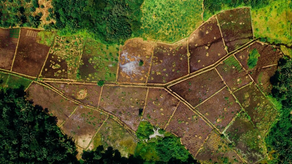
Topographic mapping is a crucial aspect of surveying and land mapping, and the use of drone services has revolutionized this field. Drones equipped with high-resolution cameras and advanced sensors can capture highly accurate and detailed topographic data. This data can then be processed and analyzed to create precise topographic maps, which are essential for various industries such as construction, urban planning, and environmental management. The use of drones in topographic mapping not only saves time and resources but also improves the accuracy and efficiency of the surveying process. With drone services, surveyors can now easily access hard-to-reach areas and obtain comprehensive topographic information, leading to better decision-making and planning in land development projects.
Construction Site Monitoring
Construction site monitoring is one of the key applications of drone services in the field of surveying and land mapping. Drones equipped with high-resolution cameras and sensors can provide real-time aerial footage and data of construction sites, allowing project managers and engineers to monitor the progress and identify any potential issues or safety hazards. This technology not only improves efficiency and accuracy in monitoring but also enhances overall safety on construction sites. With drone services, construction companies can save time and resources by reducing the need for manual inspections and surveys, while also ensuring that projects are executed smoothly and in compliance with regulations. Overall, the integration of drone services in construction site monitoring has revolutionized the way surveying and land mapping is conducted, providing a more cost-effective and reliable solution for the industry.
Environmental Assessment
Environmental assessment is a crucial step in any surveying and land mapping project. With the help of drone services, this process becomes even more efficient and accurate. Drones equipped with high-resolution cameras and advanced sensors can quickly capture detailed aerial imagery and collect data on various environmental factors. This data can then be analyzed to assess the impact of the project on the surrounding environment, including vegetation, wildlife, and water bodies. By using drone services for environmental assessment, surveyors and land mappers can make informed decisions and take necessary measures to minimize any negative effects on the ecosystem. Additionally, the use of drones reduces the need for manual labor and minimizes the risks associated with traditional surveying methods. Overall, integrating drone services into the environmental assessment phase enhances the accuracy, speed, and sustainability of surveying and land mapping projects.
Challenges and Limitations of Drone Services in Surveying and Land Mapping
Regulatory Restrictions
Regulatory restrictions play a crucial role in the use of drone services for surveying and land mapping. As the popularity of drones continues to rise, governments around the world have implemented regulations to ensure safety and privacy. These restrictions often include limitations on flight altitude, distance from airports, and areas where drones are not allowed to operate. Compliance with these regulations is essential for drone service providers to avoid legal consequences and maintain public trust. Despite the challenges posed by regulatory restrictions, advancements in technology and collaboration between industry stakeholders and regulatory bodies are paving the way for more streamlined and efficient drone services in the field of surveying and land mapping.
Weather Conditions
Weather conditions play a crucial role in the success of drone services for surveying and land mapping. Drones are highly sensitive to weather conditions such as wind, rain, and temperature. Strong winds can affect the stability and control of the drone, making it difficult to capture accurate data. Rain can damage the drone’s electrical components and compromise its ability to fly. Extreme temperatures can also impact the performance of the drone’s batteries, reducing flight time and overall efficiency. Therefore, it is essential to consider the weather conditions before conducting drone surveys to ensure reliable and high-quality results.
Technical Limitations
Drone technology has revolutionized the field of surveying and land mapping, providing numerous benefits and advancements. However, it is important to acknowledge the technical limitations that come with using drones for these purposes. One of the main limitations is the limited battery life of drones, which restricts the amount of time they can spend in the air collecting data. Additionally, drones may encounter challenges in adverse weather conditions, such as strong winds or heavy rain, which can affect their stability and performance. Another limitation is the limited payload capacity of drones, which restricts the type and amount of equipment that can be carried for data collection. Despite these limitations, the use of drones in surveying and land mapping continues to expand, and advancements in technology are constantly addressing these challenges.
Future Trends in Drone Services for Surveying and Land Mapping

Integration of Artificial Intelligence
The integration of artificial intelligence (AI) in drone services has revolutionized the field of surveying and land mapping. AI algorithms enable drones to analyze and process vast amounts of data collected during surveys, significantly reducing the time and effort required for data analysis. With AI, drones can quickly detect patterns, identify objects of interest, and generate accurate 3D models of the surveyed area. This integration not only enhances the efficiency and accuracy of surveying and land mapping but also opens up new possibilities for advanced data analysis and decision-making. By leveraging AI-powered drone services, industries such as construction, agriculture, and environmental monitoring can make informed decisions, improve productivity, and minimize costs.
Advancements in Sensor Technology
Advancements in sensor technology have greatly contributed to the enhancement of drone services in surveying and land mapping. With the development of high-resolution cameras, LiDAR sensors, and thermal imaging technology, drones are now capable of capturing precise and detailed data from the air. These sensors enable drones to collect accurate measurements, identify topographical features, and detect changes in the landscape. By utilizing these advanced sensors, surveyors and land mappers can obtain more reliable and comprehensive data, leading to more efficient and accurate results. The integration of sensor technology with drone services has revolutionized the field of surveying and land mapping, providing professionals with a powerful tool to streamline their operations and deliver high-quality outcomes.
Enhanced Data Processing and Analysis
Enhanced data processing and analysis is one of the key benefits of using drone services in surveying and land mapping. Drones are equipped with advanced sensors and cameras that can capture high-resolution images and collect accurate data. This data can then be processed and analyzed using specialized software, allowing surveyors and land mappers to obtain detailed and precise information. By leveraging drone technology, the time and effort required for data processing and analysis are significantly reduced, leading to faster and more efficient surveying and mapping processes. Additionally, the use of drones enables better visualization of the data, as it can be transformed into 3D models and maps, providing a more comprehensive understanding of the surveyed area. Overall, the integration of drone services in surveying and land mapping enhances the accuracy, speed, and quality of data processing and analysis, revolutionizing the industry.
Conclusion

Summary of Benefits and Applications
Drones have revolutionized the field of surveying and land mapping, providing numerous benefits and applications. One of the key advantages of using drone services is the ability to collect data quickly and accurately. Drones equipped with high-resolution cameras and sensors can capture detailed images and measurements of large areas in a fraction of the time it would take using traditional methods. This not only saves time and resources but also allows for more frequent and up-to-date surveys. Additionally, drones can access hard-to-reach or hazardous areas, such as steep terrains or construction sites, without putting surveyors at risk. By providing a bird’s-eye view, drones enable surveyors to gather comprehensive data and identify potential issues more efficiently. Furthermore, the data collected by drones can be easily processed and analyzed using advanced software, allowing for faster decision-making and more accurate results. Overall, the use of drone services in surveying and land mapping offers significant improvements in efficiency, safety, and data quality, making it an indispensable tool for professionals in the field.
Importance of Embracing Drone Services
The importance of embracing drone services in surveying and land mapping cannot be overstated. Drones offer a range of benefits that traditional surveying methods simply cannot match. Firstly, drones provide a bird’s eye view of the land, allowing surveyors to capture detailed and accurate images from above. This perspective enables them to gather data more efficiently and identify potential issues or areas of interest that may have been overlooked using ground-based methods. Additionally, drones equipped with advanced sensors and imaging technology can collect data in real-time, providing instant feedback and reducing the time and cost associated with manual data collection and analysis. Furthermore, the use of drones in surveying and land mapping enhances safety by minimizing the need for surveyors to work in hazardous or hard-to-reach areas. Overall, embracing drone services is a game-changer in the field of surveying and land mapping, revolutionizing the way data is collected, analyzed, and utilized.
Future Outlook
The future outlook for drone services in surveying and land mapping is highly promising. With advancements in technology and the increasing demand for accurate and efficient data collection, drones are poised to play a crucial role in the industry. These unmanned aerial vehicles offer several advantages, such as the ability to access hard-to-reach areas, capture high-resolution imagery, and collect data in real-time. Moreover, drones can significantly reduce costs and improve safety by eliminating the need for manual surveying and mapping processes. As the technology continues to evolve and regulations become more standardized, we can expect to see even greater integration of drones in surveying and land mapping practices. The future holds immense potential for the use of drone services, revolutionizing the way we survey and map land.


