
Introduction
Definition of drone services
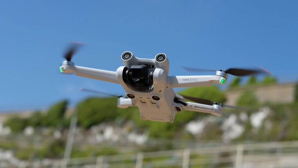
Drone services refer to the use of unmanned aerial vehicles (UAVs) to capture high-quality aerial photographs and videos. These services have gained popularity in recent years due to their numerous benefits and applications in various industries. By utilizing drones, photographers and videographers can capture unique perspectives and stunning visuals that were once only possible with expensive equipment and manned aircraft. Additionally, drone services offer increased safety and efficiency, as they eliminate the need for human operators to be present in risky or hard-to-reach locations. Whether it’s for real estate, construction, or event coverage, drone services have revolutionized the field of aerial photography and have become an invaluable tool for capturing breathtaking shots.
Importance of aerial photography
Aerial photography plays a crucial role in various industries and has become increasingly popular due to the advancements in drone technology. One of the key benefits of using drone services for aerial photography is the ability to capture unique and stunning perspectives that were previously difficult or impossible to achieve. This is especially valuable in industries such as real estate, construction, and tourism, where high-quality visuals are essential for marketing and decision-making purposes. Additionally, aerial photography allows for efficient and cost-effective data collection, enabling businesses to gather accurate and detailed information about their projects or locations. Overall, the importance of aerial photography cannot be overstated, as it provides a powerful tool for businesses to enhance their marketing strategies, improve project management, and make informed decisions.
Overview of the article
In this article, we will provide an overview of the benefits of using drone services for aerial photography. Drone technology has revolutionized the field of photography, allowing photographers to capture stunning aerial shots that were once only possible with expensive equipment and helicopters. Using drones for aerial photography offers numerous advantages, such as cost-effectiveness, flexibility, and the ability to capture unique perspectives. Additionally, drones can access hard-to-reach areas and provide real-time footage, making them invaluable for various industries including real estate, construction, and tourism. With the increasing popularity of drones, it is important to understand the benefits they offer and how they can enhance the art of photography.
Advantages of Using Drone Services

Cost-effective
Drone services for aerial photography offer a cost-effective solution for capturing stunning images and videos from unique perspectives. Unlike traditional methods that require expensive equipment and manpower, drones can be operated at a fraction of the cost. By eliminating the need for helicopters or cranes, drone services not only reduce expenses but also increase efficiency. With their ability to quickly maneuver and capture high-quality images, drones provide a cost-effective option for businesses and individuals looking to showcase their properties or capture memorable moments from above.
Versatile and flexible
Drone services for aerial photography offer unparalleled versatility and flexibility. With the ability to capture stunning images and videos from various angles and heights, drones provide a unique perspective that traditional photography methods cannot achieve. Whether it’s capturing breathtaking landscapes, documenting construction progress, or creating captivating marketing materials, drones can adapt to a wide range of needs and deliver exceptional results. Additionally, drones can easily navigate challenging terrains and hard-to-reach locations, making them an invaluable tool for professionals in industries such as real estate, filmmaking, and surveying. The versatility and flexibility of drone services make them an indispensable asset for anyone seeking high-quality aerial photography.
Access to hard-to-reach areas
Access to hard-to-reach areas is one of the key benefits of using drone services for aerial photography. Drones can easily navigate through challenging terrains, such as rugged mountains, dense forests, or inaccessible construction sites. This allows photographers to capture stunning images and videos from unique angles and perspectives that were previously impossible to achieve. Whether it’s documenting remote landscapes, capturing wildlife in their natural habitats, or inspecting hard-to-reach structures, drones provide a valuable tool for photographers to explore and capture the beauty of places that were once difficult to access.
Improved Safety

Reduced risk to human operators
Reduced risk to human operators is one of the major advantages of using drone services for aerial photography. Traditional aerial photography methods often involve sending human operators up in helicopters or airplanes, which can be dangerous and put their lives at risk. With drones, however, the need for human operators to be physically present in the air is eliminated. This not only ensures the safety of the operators but also reduces the chances of accidents and injuries. Drones can easily navigate through difficult terrains and capture high-quality aerial images without risking the lives of human operators. This makes drone services a much safer and more efficient option for aerial photography.
Ability to monitor hazardous environments
Drone services offer the ability to monitor hazardous environments with ease and efficiency. By using drones for aerial photography, professionals can safely gather data and images from areas that are difficult or dangerous to access. This includes monitoring industrial sites, disaster zones, and other high-risk locations. Drones equipped with advanced sensors and cameras can capture detailed information and provide real-time updates, allowing for better decision-making and risk management. With their ability to navigate challenging terrains and capture high-resolution images, drone services have revolutionized the way hazardous environments are monitored, ensuring the safety of both professionals and the surrounding communities.
Enhanced emergency response capabilities
Enhanced emergency response capabilities is one of the key benefits of using drone services for aerial photography. Drones equipped with high-resolution cameras and thermal imaging technology can quickly assess and survey emergency situations, providing real-time data to first responders. This allows emergency personnel to make informed decisions and respond more effectively to incidents such as natural disasters, accidents, or search and rescue operations. By providing a bird’s-eye view of the affected area, drones enable emergency responders to identify potential hazards, locate survivors, and coordinate rescue efforts efficiently. The use of drones in emergency response not only saves valuable time but also enhances the safety of both responders and the public.
High-Quality Imagery

Ability to capture stunning aerial shots
The ability to capture stunning aerial shots is one of the key benefits of using drone services for aerial photography. Drones provide a unique perspective that is not possible with traditional photography methods. They can fly at various altitudes and angles, allowing photographers to capture breathtaking views and create visually captivating images. Whether it’s capturing a bird’s eye view of a landscape or getting up close to a subject, drones offer endless possibilities for creating stunning aerial shots. Additionally, drones are equipped with high-resolution cameras that can capture intricate details and vibrant colors, resulting in professional-quality photographs. With the ability to capture shots from different heights and positions, photographers can showcase their creativity and deliver truly remarkable images. Overall, the ability to capture stunning aerial shots is a game-changer in the field of photography, opening up new possibilities and pushing the boundaries of creativity.
Higher resolution and image quality
Higher resolution and image quality are two key advantages of using drone services for aerial photography. Drones are equipped with high-resolution cameras that can capture stunning images from unique angles and perspectives. The advanced technology used in drones ensures that the images are sharp, clear, and detailed. This allows photographers and videographers to capture every minute detail of the subject, resulting in breathtaking visuals. Moreover, the ability of drones to fly at different altitudes and positions enables them to capture images with higher resolution than traditional photography methods. Overall, the use of drone services for aerial photography enhances the quality of the images and provides a whole new level of visual experience.
Wide range of camera options
One of the key advantages of using drone services for aerial photography is the wide range of camera options available. Drones can be equipped with various types of cameras, including high-resolution cameras, thermal cameras, and even specialized cameras for capturing specific types of images. This versatility allows photographers to capture stunning aerial shots from different perspectives and with different visual effects. Whether it’s capturing detailed landscapes, monitoring wildlife, or conducting inspections, the wide range of camera options provided by drone services ensures that photographers have the right tools to meet their specific needs.
Time and Efficiency
Faster data collection and analysis
Faster data collection and analysis is one of the key benefits of using drone services for aerial photography. Traditional methods of data collection, such as manual surveys or satellite imagery, can be time-consuming and labor-intensive. With drones, however, data can be collected quickly and efficiently. Drones are equipped with high-resolution cameras and sensors that can capture detailed images and data from various angles and heights. This allows for a more comprehensive and accurate analysis of the area being surveyed. Additionally, the data collected by drones can be processed and analyzed in real-time, providing immediate insights and actionable information. This speed and efficiency in data collection and analysis not only saves time and resources but also enables faster decision-making and problem-solving in various industries, including construction, agriculture, and environmental monitoring.
Reduced project turnaround time
Reduced project turnaround time is one of the key advantages of utilizing drone services for aerial photography. In traditional photography methods, capturing images from different angles and heights can be time-consuming and labor-intensive. However, with drones, photographers can swiftly maneuver the unmanned aircraft to capture stunning aerial shots in a fraction of the time. This not only saves valuable time but also allows for quicker project completion and delivery. By using drone services, businesses and individuals can significantly reduce the time it takes to obtain high-quality aerial photographs, enabling them to meet tight deadlines and stay ahead of the competition.
Increased productivity
Increased productivity is one of the key advantages of using drone services for aerial photography. Drones are equipped with advanced technology and high-resolution cameras that allow for efficient and accurate data collection. With drones, photographers can cover large areas in a short amount of time, eliminating the need for manual labor and reducing the time and cost associated with traditional photography methods. This increased efficiency translates to higher productivity, as photographers can capture more images and complete projects faster. Additionally, the ability to access hard-to-reach locations and capture unique angles and perspectives further enhances the productivity and creativity of aerial photography using drones.
Applications of Drone Services
Real estate and property marketing
Real estate and property marketing has been revolutionized by the use of drone services for aerial photography. With the ability to capture stunning aerial shots of properties, drones have become an invaluable tool for showcasing real estate listings. These high-quality images provide potential buyers with a unique and immersive perspective, allowing them to visualize the property’s layout, surrounding landscape, and overall appeal. Additionally, drone photography offers a cost-effective solution for real estate agents and developers, eliminating the need for expensive helicopter rentals or hiring professional photographers. By leveraging the power of drone services, real estate professionals can effectively market properties and attract a wider audience, ultimately leading to faster sales and increased profitability.
Construction and infrastructure inspection
Construction and infrastructure inspection is one area where the benefits of using drone services for aerial photography are particularly evident. Drones provide a cost-effective and efficient solution for inspecting construction sites and infrastructure, such as bridges, buildings, and roadways. With their ability to capture high-resolution images and videos from various angles and heights, drones enable inspectors to identify potential issues and monitor progress with greater accuracy and detail. This not only saves time and resources but also enhances safety by reducing the need for manual inspections in potentially hazardous environments. Additionally, the use of drones for construction and infrastructure inspection allows for real-time data collection and analysis, facilitating informed decision-making and timely problem resolution. Overall, the integration of drone services in this field offers numerous advantages, improving efficiency, accuracy, and safety in construction and infrastructure projects.
Agriculture and land surveying
Agriculture and land surveying are two areas that greatly benefit from the use of drone services for aerial photography. Drones equipped with high-resolution cameras can capture detailed images of crops, allowing farmers to monitor their growth and identify areas that require attention. This data can help optimize irrigation, detect pest infestations, and improve overall crop yields. Additionally, drones can be used for land surveying, providing accurate and up-to-date topographic data for mapping purposes. By using drone services, farmers and land surveyors can save time and resources while gaining valuable insights to enhance their operations.


