
Introduction
Definition of drone services
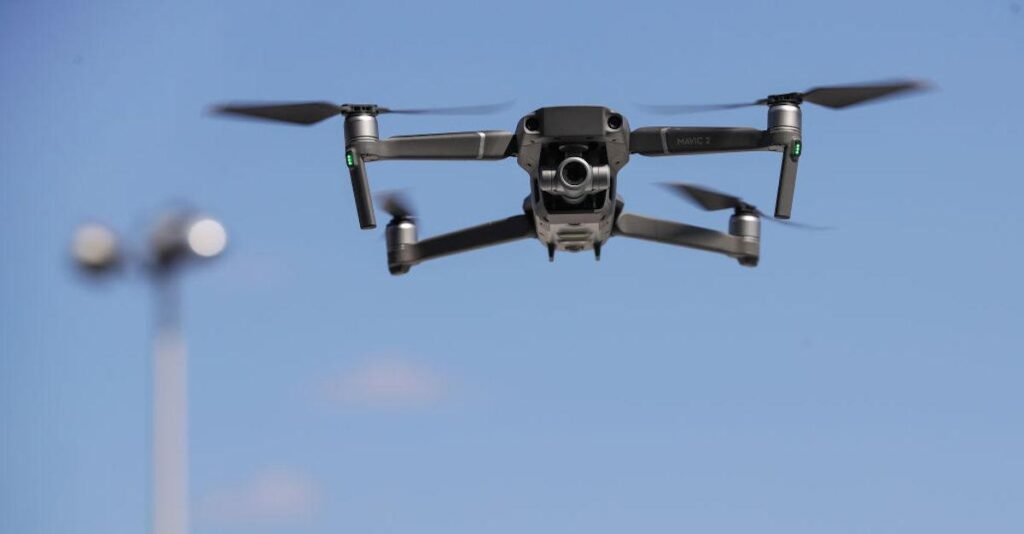
Drone services refer to the use of unmanned aerial vehicles (UAVs) for various applications and tasks. These drones are equipped with advanced technology and sensors that enable them to collect data, capture images and videos, and perform specific functions. In the context of environmental conservation, drone services play a crucial role in monitoring and assessing ecosystems, wildlife populations, and natural resources. They provide a cost-effective and efficient way to gather information from remote and inaccessible areas, allowing researchers and conservationists to make informed decisions and take necessary actions to protect and preserve the environment. By providing a bird’s eye view and real-time data, drone services have revolutionized environmental monitoring and conservation efforts, contributing to the sustainable management of our planet’s natural resources.
Importance of environmental conservation
Environmental conservation plays a crucial role in preserving the delicate balance of our planet’s ecosystems. It is of utmost importance to protect and sustain our natural resources for the well-being of current and future generations. One of the emerging tools in this endeavor is the use of drone services. Drones offer a unique perspective and enable us to monitor and manage environmental conservation efforts more effectively. They can be used to survey and map areas, monitor wildlife populations, detect and prevent illegal activities, and even assist in reforestation projects. By harnessing the power of drone technology, we can enhance our understanding of the environment, make informed decisions, and take proactive measures to safeguard our planet’s biodiversity and ecological health.
Overview of the article
In this article, we will explore the role of drone services in environmental conservation. Drones, also known as unmanned aerial vehicles (UAVs), have revolutionized various industries, including environmental conservation. They offer a unique perspective and advanced capabilities that can aid in monitoring, research, and protection of the environment. By using drones, scientists and conservationists can gather valuable data, conduct surveys, and track wildlife populations more efficiently and accurately. Additionally, drones can be used to identify and address environmental threats such as deforestation, illegal poaching, and pollution. With their ability to reach remote and inaccessible areas, drones have become an invaluable tool in the fight against environmental degradation. This article will delve into the various applications of drone services in environmental conservation and highlight their potential to make a significant impact in preserving our planet.
Applications of Drones in Environmental Conservation
Monitoring wildlife populations
Monitoring wildlife populations is a crucial aspect of environmental conservation, and drone services have emerged as a valuable tool in this endeavor. Drones equipped with high-resolution cameras and advanced sensors can provide researchers and conservationists with a bird’s-eye view of wildlife habitats, allowing them to monitor populations and track their movements with unprecedented precision. This technology enables the collection of data on species abundance, distribution, and behavior, which is essential for making informed decisions regarding conservation strategies and resource allocation. By using drone services for wildlife monitoring, we can gain valuable insights into the health and dynamics of ecosystems, ultimately contributing to the preservation of biodiversity and the protection of endangered species.
Mapping and surveying
Mapping and surveying play a crucial role in environmental conservation efforts, and drone services have revolutionized these processes. Drones equipped with advanced imaging technology can quickly and accurately capture high-resolution aerial images of vast areas, providing valuable data for mapping and surveying purposes. This technology allows environmental researchers and conservationists to efficiently monitor and assess the health of ecosystems, identify potential threats, and develop effective conservation strategies. By utilizing drone services for mapping and surveying, environmental organizations can gather comprehensive and up-to-date information, enabling them to make informed decisions and take proactive measures to protect and preserve our natural resources.
Identifying and addressing environmental threats
Identifying and addressing environmental threats is crucial in the field of environmental conservation. With the advent of drone services, the task of identifying these threats has become more efficient and accurate. Drones equipped with advanced sensors and cameras can survey vast areas of land and water, providing valuable data on various environmental factors. This data can then be analyzed to identify potential threats such as deforestation, pollution, and habitat destruction. By pinpointing these threats, environmental organizations and authorities can take timely action to address them and prevent further damage to the ecosystem. The use of drone services in environmental conservation not only enhances the effectiveness of conservation efforts but also minimizes the risks and costs associated with traditional methods of threat identification and monitoring.
Benefits of Drone Services in Environmental Conservation
Cost-effectiveness
Cost-effectiveness is a crucial factor when it comes to the role of drone services in environmental conservation. Drones offer a cost-effective solution for various tasks such as monitoring wildlife, surveying land, and assessing the health of ecosystems. Compared to traditional methods, drones can cover larger areas in a shorter amount of time, reducing the need for manual labor and resources. Additionally, the use of drones eliminates the risk of human error and provides accurate data for informed decision-making. By leveraging drone technology, environmental organizations can maximize their efficiency and allocate their resources more effectively, ultimately contributing to the preservation and protection of our natural environment.
Efficiency and accuracy
Efficiency and accuracy are two key factors that make drone services invaluable in environmental conservation efforts. Drones are equipped with advanced technology that allows them to collect data and monitor various aspects of the environment with precision and speed. This enables researchers and conservationists to gather real-time information on wildlife populations, habitat conditions, and the impact of human activities on the ecosystem. By providing a bird’s-eye view of the landscape, drones can cover large areas quickly and efficiently, reducing the time and resources required for traditional ground surveys. Additionally, the data collected by drones can be analyzed and interpreted using sophisticated algorithms, providing valuable insights for decision-making and conservation planning. Overall, the use of drone services in environmental conservation enhances the efficiency and accuracy of data collection, leading to more effective conservation strategies and better protection of our natural resources.
Reduced risk to human operators
Reduced risk to human operators is one of the key advantages of using drone services in environmental conservation. Traditionally, tasks such as monitoring wildlife, surveying remote areas, and collecting data in hazardous environments required human operators to physically be present, putting them at risk of injury or harm. However, with the use of drones, these tasks can now be performed remotely, eliminating the need for human operators to be exposed to dangerous situations. Drones can navigate difficult terrains, access hard-to-reach locations, and withstand extreme weather conditions, ensuring that critical conservation efforts can be carried out safely and efficiently. By reducing the risk to human operators, drone services are revolutionizing the field of environmental conservation and enabling researchers and conservationists to gather valuable data without compromising their safety.
Challenges and Limitations of Drone Services
Regulatory restrictions
Regulatory restrictions play a crucial role in shaping the use of drone services in environmental conservation. As drones become increasingly popular for various applications, including monitoring wildlife, mapping ecosystems, and assessing environmental damage, it is essential to have clear guidelines and regulations in place to ensure their responsible and ethical use. These restrictions help protect sensitive habitats, prevent disturbance to wildlife, and minimize the risk of accidents or unauthorized access to restricted areas. By adhering to regulatory requirements, drone operators can contribute to the effective and sustainable implementation of environmental conservation efforts.
Battery life and flight time limitations
Battery life and flight time limitations are crucial factors to consider when utilizing drone services for environmental conservation. Drones are powered by batteries, which have a limited capacity and can only sustain flight for a certain amount of time. This limitation poses challenges in conducting long-duration surveys or monitoring activities in remote areas. To overcome this, drone operators need to carefully plan their missions, taking into account the battery life and flight time limitations. They may need to strategically position charging stations or carry extra batteries to ensure uninterrupted operations. Additionally, advancements in battery technology and the development of more efficient drones are continuously being explored to extend flight times and improve the overall performance of drone services in environmental conservation efforts.
Weather conditions and environmental factors
Weather conditions and environmental factors play a crucial role in the effectiveness of drone services in environmental conservation. Drones are equipped with advanced sensors and cameras that can capture valuable data and imagery. However, adverse weather conditions such as strong winds, heavy rain, or extreme temperatures can hinder the performance of drones and limit their ability to collect accurate and reliable data. Additionally, environmental factors such as dense vegetation, rugged terrain, or unpredictable wildlife behavior can pose challenges for drone operations. Therefore, it is essential for drone operators and environmental conservationists to carefully assess weather conditions and environmental factors before deploying drones for conservation purposes. By understanding and adapting to these conditions, drone services can be optimized to effectively contribute to environmental conservation efforts.
Case Studies: Successful Implementation of Drone Services
Monitoring endangered species
Monitoring endangered species is a crucial aspect of environmental conservation, and drone services have emerged as a valuable tool in this endeavor. Drones equipped with high-resolution cameras and advanced sensors can cover large areas of land and capture detailed images and data of endangered species and their habitats. This technology allows researchers and conservationists to monitor the population size, behavior, and movement patterns of these species, providing valuable insights for their protection and management. Additionally, drones can access remote and inaccessible areas, enabling the monitoring of species in hard-to-reach locations. By using drone services for monitoring endangered species, we can enhance our understanding of their needs and implement targeted conservation strategies to ensure their survival and well-being.
Mapping deforestation and illegal logging
Mapping deforestation and illegal logging plays a crucial role in environmental conservation efforts. Drones have emerged as a powerful tool in this regard, providing a cost-effective and efficient means of monitoring and documenting deforestation activities. Equipped with high-resolution cameras and advanced imaging technology, drones can capture detailed aerial images of forested areas, allowing experts to identify and track instances of deforestation and illegal logging. This data can then be used to inform conservation strategies, enforce regulations, and hold accountable those responsible for the destruction of our natural resources. By leveraging drone services for mapping deforestation and illegal logging, we can better understand the extent of these activities, take proactive measures to protect our forests, and work towards a more sustainable future.
Assessing and mitigating pollution
Assessing and mitigating pollution is a crucial aspect of environmental conservation. With the advancements in drone technology, the role of drone services in this area has become increasingly significant. Drones equipped with high-resolution cameras and sensors can be used to monitor and assess pollution levels in various environments, including air, water, and land. This real-time data allows environmentalists and policymakers to identify pollution sources and take necessary actions to mitigate them. Additionally, drones can also be used to conduct aerial surveys and inspections of industrial sites, ensuring compliance with environmental regulations. By leveraging drone services, we can enhance our efforts in assessing and mitigating pollution, ultimately contributing to a healthier and more sustainable environment.
Future Trends and Potential of Drone Services in Environmental Conservation
Advancements in drone technology
Advancements in drone technology have revolutionized the field of environmental conservation. Drones now play a crucial role in monitoring and protecting natural resources, providing valuable data and insights to scientists and conservationists. With their ability to capture high-resolution images and videos, drones enable researchers to study remote and inaccessible areas, such as dense forests and rugged terrains, without disturbing the delicate ecosystems. Moreover, drones equipped with advanced sensors and cameras can detect and track wildlife populations, helping to monitor endangered species and prevent illegal activities such as poaching. The use of drones in environmental conservation has not only increased efficiency and accuracy but has also reduced costs and risks associated with traditional methods. As drone technology continues to advance, we can expect even greater contributions in preserving and safeguarding our planet’s biodiversity.
Integration with artificial intelligence
Integration with artificial intelligence is revolutionizing the field of drone services in environmental conservation. By combining the power of AI algorithms with the capabilities of drones, researchers and conservationists are able to gather and analyze vast amounts of data in real-time. This integration allows for more accurate and efficient monitoring of ecosystems, wildlife populations, and environmental changes. AI-powered drones can identify and track specific species, detect changes in vegetation patterns, and even predict natural disasters. With the ability to collect and process data at a rapid pace, drone services integrated with AI are playing a crucial role in understanding and protecting our planet’s delicate ecosystems.
Collaboration with other conservation efforts
Collaboration with other conservation efforts is crucial in maximizing the impact of drone services in environmental conservation. By working together with organizations and initiatives focused on protecting and preserving natural resources, drone services can complement existing efforts and enhance the effectiveness of conservation projects. Drones provide a unique perspective and data collection capabilities that can contribute valuable insights to the overall conservation strategy. Whether it is monitoring wildlife populations, mapping deforestation, or assessing the health of ecosystems, the collaboration between drone services and other conservation efforts can lead to more informed decision-making and targeted conservation actions. This partnership fosters a holistic approach to environmental conservation, where technology and traditional conservation practices converge to create a more sustainable future.


