Introduction
Definition of Drone Services
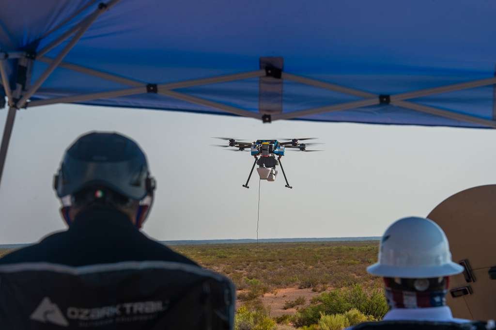
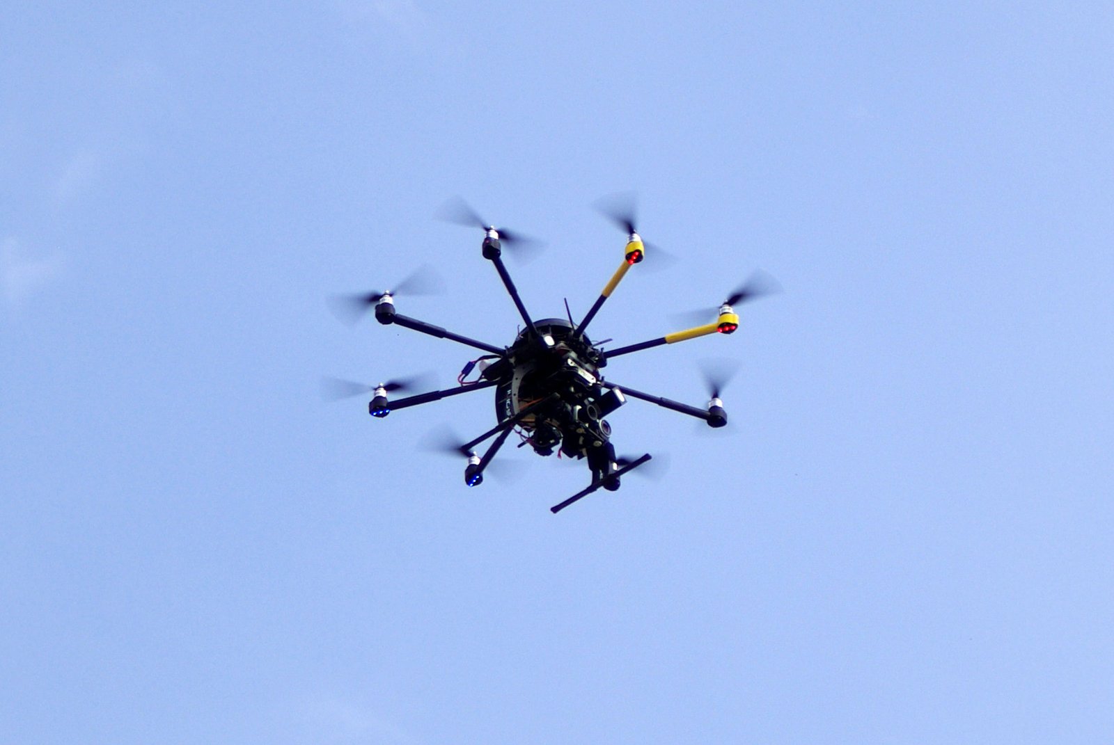
Drone services refer to the use of unmanned aerial vehicles (UAVs) to provide various mapping and surveying solutions. These services involve the deployment of drones equipped with high-resolution cameras, LiDAR sensors, and other advanced technologies to capture accurate and detailed data from the air. By utilizing drones, mapping and surveying tasks can be conducted more efficiently and cost-effectively compared to traditional methods. Drone services have revolutionized the field of mapping and surveying by offering faster data collection, enhanced accuracy, and improved safety. They are widely used in industries such as construction, agriculture, environmental monitoring, and infrastructure development.
Importance of Mapping and Surveying
Mapping and surveying play a crucial role in various industries, and the advent of drone services has further revolutionized these processes. The importance of mapping and surveying lies in their ability to provide accurate and detailed information about the physical characteristics of an area. This information is essential for urban planning, infrastructure development, and environmental management. By using drones, mapping and surveying can be conducted more efficiently and cost-effectively, as drones can access remote and difficult-to-reach locations. Moreover, drones equipped with advanced sensors and cameras can capture high-resolution imagery and collect precise data, enabling professionals to create accurate maps, identify potential risks, and make informed decisions. Therefore, the integration of drone services in mapping and surveying has significantly enhanced the speed, accuracy, and overall effectiveness of these processes.
Overview of the Article
In this article, we will provide an overview of the role of drone services in mapping and surveying. Drones have revolutionized the field of mapping and surveying by offering efficient and cost-effective solutions. They are equipped with advanced technology such as high-resolution cameras, LiDAR sensors, and GPS systems, which enable them to capture accurate and detailed data. Drone services have the ability to quickly and accurately map large areas of land, making them invaluable in various industries such as construction, agriculture, and environmental monitoring. Additionally, drones can access hard-to-reach areas and hazardous environments, reducing the risk to human surveyors. Overall, the use of drone services in mapping and surveying has significantly improved efficiency, accuracy, and safety in these fields.
Benefits of Drone Services in Mapping and Surveying

Improved Efficiency and Accuracy
Improved efficiency and accuracy are two key benefits of using drone services in mapping and surveying. With the ability to capture high-resolution aerial images and collect data from various angles, drones significantly reduce the time and effort required for traditional surveying methods. The use of drones also eliminates the need for manual measurements and reduces the chances of human error, resulting in more precise and reliable data. Additionally, the real-time data collection and processing capabilities of drones allow for immediate analysis and decision-making, further improving the efficiency of mapping and surveying projects. Overall, the integration of drone services in mapping and surveying operations leads to faster, more accurate, and cost-effective results.
Cost-Effectiveness
Drone services have revolutionized the field of mapping and surveying by offering a cost-effective solution. Traditional methods of mapping and surveying often involve high costs due to the need for specialized equipment, manpower, and time-consuming processes. However, with the advent of drone technology, these costs have been significantly reduced. Drones can quickly and accurately capture aerial images and data, eliminating the need for expensive equipment and reducing the time required for surveying large areas. This cost-effectiveness has made drone services an attractive option for industries such as construction, agriculture, and environmental monitoring, where accurate mapping and surveying are essential for decision-making and planning.
Enhanced Safety
Enhanced Safety: One of the key advantages of using drone services in mapping and surveying is the enhanced safety it provides. Traditional methods of mapping and surveying often involve sending personnel to remote or hazardous locations, putting them at risk of accidents or injuries. With drones, these risks are significantly reduced as they can access hard-to-reach areas without endangering human lives. Additionally, drones are equipped with advanced sensors and cameras that can capture high-resolution images and data, allowing surveyors to gather accurate information from a safe distance. This not only improves the safety of personnel but also ensures the quality and reliability of the collected data.
Applications of Drone Services in Mapping and Surveying
Land Surveying
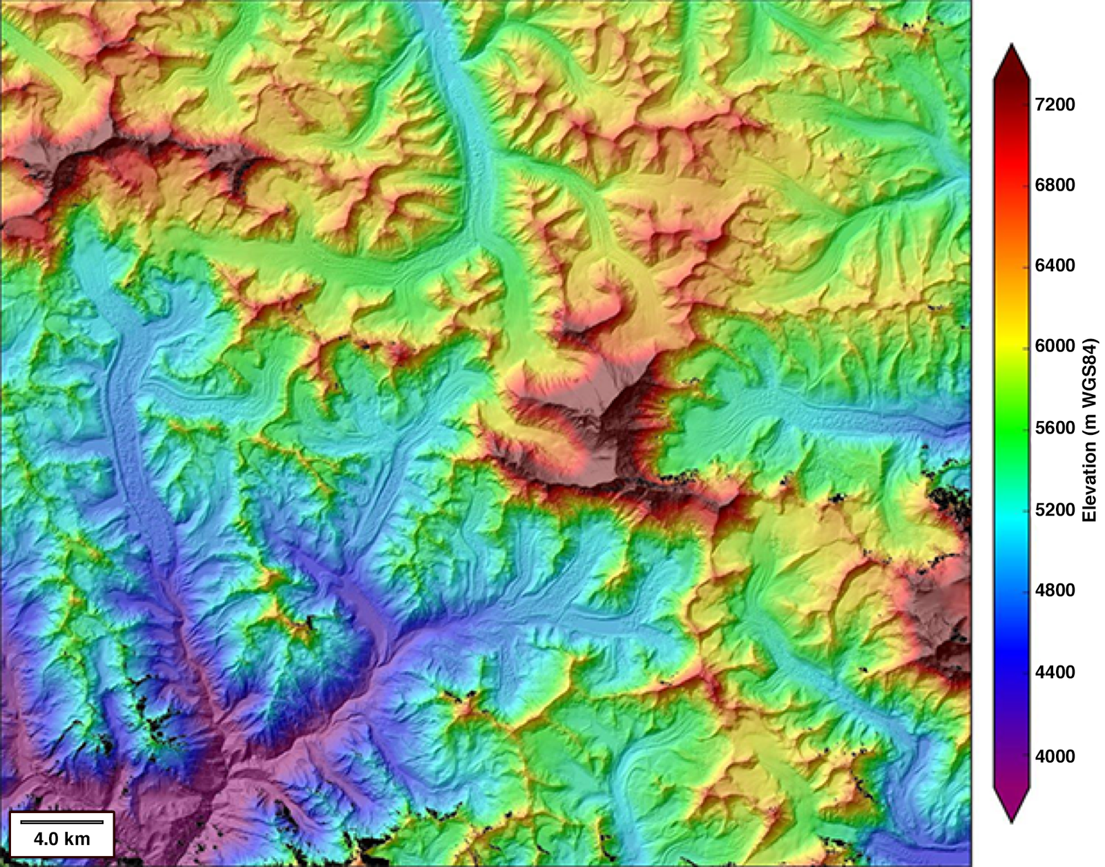
Land surveying plays a crucial role in the field of mapping and surveying. It involves the measurement and mapping of land and its features, such as boundaries, topography, and elevation. Traditionally, land surveying was a time-consuming and labor-intensive process, requiring surveyors to physically visit the site and use various tools and equipment. However, with the advent of drone services, land surveying has become faster, more accurate, and more efficient. Drones equipped with high-resolution cameras and LiDAR sensors can capture detailed aerial images and collect data points with precision. This technology allows surveyors to quickly and accurately create topographic maps, identify potential obstacles, and assess the condition of the land. By utilizing drone services in land surveying, professionals can save time, reduce costs, and improve the overall accuracy of mapping and surveying projects.
Infrastructure Inspection
Infrastructure inspection is one of the key applications of drone services in mapping and surveying. Drones equipped with advanced imaging technology and sensors can efficiently inspect various types of infrastructure, including bridges, buildings, power lines, and pipelines. These aerial inspections provide a comprehensive view of the infrastructure, allowing for early detection of any potential issues such as structural damage or corrosion. By using drones for infrastructure inspection, companies can save time, reduce costs, and improve safety by minimizing the need for manual inspections. Overall, the use of drone services in infrastructure inspection is revolutionizing the way we monitor and maintain our critical infrastructure.
Environmental Monitoring
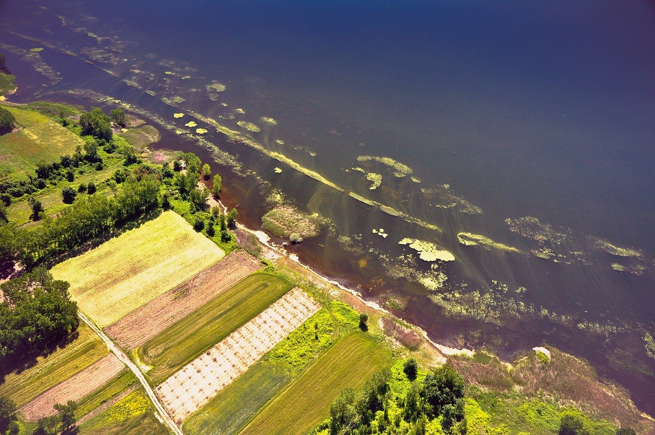
Environmental monitoring is a crucial aspect of drone services in mapping and surveying. Drones equipped with advanced sensors and cameras can collect valuable data on various environmental factors, including air quality, water quality, and vegetation health. This data can then be used to assess the impact of human activities on the environment, identify areas of concern, and develop effective strategies for conservation and sustainable development. By providing real-time and accurate information, drone services are revolutionizing environmental monitoring practices, enabling faster and more efficient decision-making processes for environmental management and protection.
Challenges and Limitations of Drone Services in Mapping and Surveying

Regulatory Restrictions
Regulatory restrictions play a crucial role in shaping the use of drone services in mapping and surveying. As drones become more prevalent in these industries, governments around the world have implemented various regulations to ensure safety, privacy, and compliance. These regulations often include restrictions on flight altitude, distance from airports, and the need for licenses or permits. By imposing these restrictions, authorities aim to prevent accidents, protect sensitive areas, and maintain control over the use of drones. While these regulations may pose challenges for drone operators, they also provide a framework for responsible and ethical use of drone services in mapping and surveying.
Weather Conditions
Weather conditions play a crucial role in the success of drone services for mapping and surveying purposes. Drones rely on clear skies, minimal wind, and stable atmospheric conditions to operate effectively and capture accurate data. Adverse weather conditions such as rain, strong winds, or fog can hinder the drone’s ability to fly safely and collect precise information. Therefore, it is essential for drone operators to carefully monitor weather forecasts and plan their mapping and surveying tasks accordingly. By taking into account the weather conditions, professionals can ensure the reliability and quality of the data collected by drone services, ultimately leading to more accurate and efficient mapping and surveying outcomes.
Data Processing and Analysis
Data processing and analysis play a crucial role in the utilization of drone services for mapping and surveying. Once the aerial data is collected, it needs to be processed and analyzed to extract valuable insights and information. This involves converting the raw data into a usable format, removing any noise or errors, and applying various algorithms and techniques to derive accurate measurements and visual representations. With advancements in technology, such as machine learning and artificial intelligence, the data processing and analysis phase has become more efficient and accurate, enabling faster and more precise mapping and surveying results. The ability to quickly process and analyze large volumes of data has also opened up new possibilities for real-time monitoring and decision-making in industries like construction, agriculture, and infrastructure development. In summary, data processing and analysis are essential components of drone services, enabling the generation of accurate and actionable information for effective mapping and surveying.
Future Trends in Drone Services for Mapping and Surveying

Advancements in Drone Technology
Advancements in drone technology have revolutionized the field of mapping and surveying. Drones equipped with high-resolution cameras and GPS capabilities can now capture detailed aerial images and collect accurate data, making traditional surveying methods seem outdated. These technological advancements have not only increased the efficiency and accuracy of mapping and surveying projects but have also reduced costs and time required for data collection. With the ability to reach remote and inaccessible areas, drones have become an indispensable tool for professionals in the mapping and surveying industry. As drone technology continues to evolve, we can expect further improvements in data collection, analysis, and mapping capabilities, opening up new possibilities for the field.
Integration with Artificial Intelligence
Integration with Artificial Intelligence is a crucial aspect of drone services in mapping and surveying. By harnessing the power of AI, drones are able to analyze and interpret the data they collect with greater accuracy and efficiency. This integration allows for real-time processing of the collected data, enabling instant identification of potential obstacles or anomalies in the surveyed area. Additionally, AI algorithms can be used to automate the mapping and surveying process, reducing the need for human intervention and minimizing errors. The combination of drone services and AI technology opens up new possibilities for more accurate and comprehensive mapping and surveying, making it an invaluable tool in various industries such as construction, agriculture, and environmental monitoring.
Expansion of Applications
The expansion of applications for drone services in mapping and surveying has been remarkable. In addition to traditional uses such as land surveying and topographic mapping, drones are now being utilized in various industries and sectors. For example, in agriculture, drones are used to monitor crop health and optimize irrigation systems. In construction, drones are used to create accurate 3D models of sites and track progress. In environmental conservation, drones are used to survey and monitor wildlife populations and habitats. The versatility and efficiency of drones have opened up new possibilities for data collection and analysis, revolutionizing the field of mapping and surveying.
Conclusion

Summary of Key Points
The role of drone services in mapping and surveying is becoming increasingly important in various industries. Drones have revolutionized the way mapping and surveying tasks are carried out, providing a faster, more efficient, and cost-effective solution. They are equipped with high-resolution cameras and advanced sensors, allowing for accurate data collection and mapping of large areas. Drone services are widely used in construction, agriculture, environmental monitoring, and infrastructure development, among other sectors. They enable professionals to gather precise measurements, create detailed 3D models, and identify potential risks or issues in a timely manner. In addition, drones can access hard-to-reach or hazardous areas, reducing the need for manual labor and ensuring the safety of personnel. Overall, the use of drone services in mapping and surveying offers numerous benefits, enhancing productivity, accuracy, and safety in various industries.
Importance of Drone Services in Mapping and Surveying
Drone services play a crucial role in mapping and surveying, offering numerous benefits and advantages. One of the key importance of drone services in mapping and surveying is their ability to access hard-to-reach areas, such as rugged terrains, dense forests, and dangerous landscapes. Drones equipped with high-resolution cameras and sensors can capture detailed imagery and collect accurate data from these areas, which would otherwise be challenging or impossible for traditional surveying methods. Additionally, drone services provide a cost-effective solution for mapping and surveying projects, as they require fewer resources and manpower compared to conventional methods. This not only reduces the overall project costs but also increases efficiency and productivity. Moreover, drone services enable faster data collection and processing, allowing for real-time monitoring and analysis of the surveyed areas. This real-time data can be used for various applications, including urban planning, infrastructure development, environmental monitoring, and disaster management. In conclusion, the importance of drone services in mapping and surveying cannot be overstated, as they offer a reliable, efficient, and cost-effective solution for obtaining accurate and up-to-date geospatial information.
Future Prospects
The future prospects of drone services in mapping and surveying are highly promising. With advancements in technology, drones are becoming more sophisticated and capable of capturing high-resolution aerial imagery and collecting accurate geospatial data. This has opened up new possibilities in various industries, including urban planning, agriculture, construction, and environmental monitoring. In the future, drones are expected to play a crucial role in the development of smart cities, precision agriculture, and disaster management. With their ability to cover large areas quickly and efficiently, drones can provide valuable insights and data that can inform decision-making and improve efficiency in various sectors. As regulations become more streamlined and the technology continues to evolve, the use of drones in mapping and surveying is likely to become even more widespread, revolutionizing the way we collect and analyze spatial information.

