
Introduction
Definition of drone services
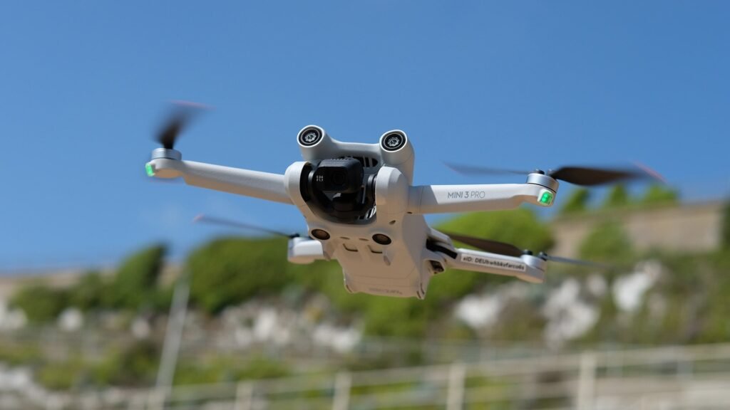
Drone services, also known as unmanned aerial vehicle (UAV) services, refer to the use of drones for various applications, including environmental monitoring and conservation. These services involve the deployment of drones equipped with advanced sensors and cameras to collect data and capture images of the environment. By utilizing drones, researchers, environmentalists, and conservationists can gather valuable information about ecosystems, wildlife populations, and natural resources. This data can then be used to assess the health of ecosystems, identify potential threats, and develop effective conservation strategies. Drone services have revolutionized environmental monitoring and conservation efforts by providing a cost-effective, efficient, and non-invasive method of data collection and analysis.
Importance of environmental monitoring and conservation
Environmental monitoring and conservation play a crucial role in safeguarding our planet’s ecosystems and natural resources. By closely observing and assessing the health of the environment, we can identify potential threats and take necessary actions to mitigate them. Monitoring allows us to track changes in air quality, water pollution, deforestation, and the overall biodiversity of an area. This information is vital for policymakers, scientists, and conservationists to make informed decisions and implement effective strategies for preserving our environment. Utilizing drone services for environmental monitoring has revolutionized the field, providing a cost-effective and efficient way to collect data and monitor remote and inaccessible areas. Drones equipped with advanced sensors and cameras can capture high-resolution images, aerial surveys, and thermal imaging, enabling us to gather accurate and real-time information about the state of our environment. With the help of drone services, we can enhance our understanding of environmental changes, identify conservation priorities, and take proactive measures to protect our natural habitats and species.
Overview of the article
The article titled ‘Using Drone Services for Environmental Monitoring and Conservation’ provides an in-depth exploration of the use of drones in the field of environmental monitoring and conservation. The article begins with an overview of the topic, highlighting the importance of monitoring and conserving the environment for sustainable development. It then delves into the various applications of drone technology in environmental monitoring, including wildlife tracking, habitat mapping, and pollution detection. The article also discusses the advantages and challenges of using drones in this context, emphasizing the potential for increased efficiency and accuracy in data collection. Overall, this article serves as a comprehensive guide for understanding the role of drone services in environmental monitoring and conservation efforts.
Benefits of Using Drone Services

Improved data collection
Improved data collection is one of the key benefits of using drone services for environmental monitoring and conservation. Drones are equipped with advanced sensors and cameras that can capture high-resolution images and videos of the environment. These images and videos provide detailed and accurate data that can be used to assess the health of ecosystems, monitor wildlife populations, and detect changes in land use. Compared to traditional methods of data collection, such as manual surveys or satellite imagery, drones offer a more efficient and cost-effective solution. They can cover large areas in a short amount of time and provide real-time data that can be analyzed and acted upon quickly. This improved data collection capability provided by drone services is crucial for making informed decisions and implementing effective conservation strategies.
Cost-effectiveness
Cost-effectiveness is a crucial factor to consider when utilizing drone services for environmental monitoring and conservation. Drones offer a cost-effective solution by reducing the need for manual labor and expensive equipment. With their ability to cover large areas quickly and efficiently, drones can collect data and monitor environmental conditions at a fraction of the cost compared to traditional methods. Additionally, the use of drones eliminates the risks associated with human involvement in hazardous or remote environments, further enhancing their cost-effectiveness. By leveraging drone technology, organizations can maximize their resources and achieve greater efficiency in their environmental monitoring and conservation efforts.
Enhanced safety
Enhanced safety is one of the key advantages of using drone services for environmental monitoring and conservation. Traditional methods of data collection often involve sending human workers into potentially hazardous environments, such as remote or inaccessible areas, or areas with dangerous wildlife. By utilizing drones, these risks can be significantly reduced or eliminated altogether. Drones can access difficult-to-reach locations and collect data without putting human lives at risk. This not only ensures the safety of the workers but also allows for more efficient and effective data collection, as drones can cover larger areas in a shorter amount of time. Additionally, drones can be equipped with various sensors and cameras to detect potential dangers or monitor environmental conditions, providing real-time information to aid in decision-making and emergency response. Overall, the use of drone services enhances safety by minimizing human risk and enabling more comprehensive and timely environmental monitoring and conservation efforts.
Applications of Drone Services in Environmental Monitoring
Wildlife tracking and population assessment
Wildlife tracking and population assessment is a crucial aspect of environmental monitoring and conservation efforts. By utilizing drone services, researchers and conservationists are able to gather valuable data on the movement patterns, behavior, and population dynamics of various species. Drones equipped with specialized cameras and sensors can track animals in their natural habitats, providing a non-invasive and cost-effective method for monitoring wildlife populations. This data can then be used to assess the health and abundance of different species, identify potential threats, and inform conservation strategies. Overall, the use of drone services for wildlife tracking and population assessment has revolutionized the field of environmental monitoring, enabling more efficient and accurate data collection for conservation efforts.
Habitat mapping and assessment
Habitat mapping and assessment play a crucial role in understanding and protecting the natural environment. Drones have emerged as a valuable tool in this process, offering a cost-effective and efficient means of collecting high-resolution data. By using drones equipped with advanced sensors and cameras, environmental researchers and conservationists can quickly and accurately map habitats, identify species distributions, and assess the health of ecosystems. This information is vital for making informed decisions regarding land management, conservation efforts, and the mitigation of potential threats to biodiversity. With the help of drone services, habitat mapping and assessment can be conducted with greater precision, speed, and accessibility, contributing to more effective environmental monitoring and conservation practices.
Water quality monitoring
Water quality monitoring plays a crucial role in environmental monitoring and conservation efforts. By using drone services, researchers and organizations can gather data on the quality of water bodies such as rivers, lakes, and oceans. Drones equipped with sensors can collect information on various parameters including temperature, pH levels, dissolved oxygen, and pollutants. This data is essential for understanding the health of aquatic ecosystems, identifying sources of pollution, and implementing effective conservation measures. Additionally, drone technology enables faster and more frequent monitoring, allowing for timely detection and response to any changes or threats to water quality. Overall, the use of drone services for water quality monitoring provides valuable insights and supports the sustainable management of our precious water resources.
Challenges and Limitations

Regulatory restrictions
Regulatory restrictions play a crucial role in the use of drone services for environmental monitoring and conservation. As the popularity of drones continues to grow, governments around the world have implemented regulations to ensure the safe and responsible use of these devices. These regulations often dictate where and when drones can be flown, as well as the maximum altitude and distance they can reach. Additionally, permits and licenses may be required for certain activities, such as flying drones in protected areas or conducting aerial surveys. While these restrictions may sometimes be seen as obstacles, they are necessary to protect wildlife, ecosystems, and the privacy of individuals. Compliance with these regulations is essential for ensuring the successful integration of drone technology in environmental monitoring and conservation efforts.
Technical limitations
Technical limitations can pose challenges when using drone services for environmental monitoring and conservation. One of the main limitations is the limited battery life of drones, which restricts the amount of time they can spend in the air collecting data. Additionally, drones may have limited payload capacity, making it difficult to carry heavy equipment or sensors. Another challenge is the limited range of drones, which may require multiple flights or the use of multiple drones to cover large areas. Finally, weather conditions such as strong winds or rain can impact the flight stability and data collection capabilities of drones. Despite these limitations, advancements in drone technology are constantly being made to overcome these challenges and improve the effectiveness of using drones for environmental monitoring and conservation efforts.
Privacy concerns
Privacy concerns are a significant factor to consider when utilizing drone services for environmental monitoring and conservation. As these unmanned aerial vehicles capture data and imagery from various locations, there is a risk of infringing upon individuals’ privacy. The use of drones for surveillance purposes can raise concerns about the collection and storage of personal information, as well as the potential for unauthorized access to sensitive data. It is crucial for organizations and regulatory bodies to establish clear guidelines and regulations to address these privacy concerns and ensure that drone operations are conducted ethically and responsibly. By implementing measures such as obtaining consent, anonymizing data, and limiting the scope of surveillance, the potential privacy risks associated with drone services can be mitigated, allowing for the effective and responsible use of this technology in environmental monitoring and conservation efforts.
Case Studies

Drone-based monitoring of endangered species
Drone-based monitoring of endangered species has emerged as a powerful tool in environmental conservation efforts. Drones equipped with high-resolution cameras and advanced sensors can efficiently survey vast areas of land, providing valuable data on the distribution and behavior of endangered species. This technology enables researchers and conservationists to gather information without disturbing the natural habitat or endangering the species. By using drones, we can obtain accurate population estimates, monitor breeding patterns, and identify potential threats to the survival of these species. Furthermore, drone-based monitoring allows for real-time data collection, enabling swift action to be taken in response to any immediate threats or disturbances. Overall, the use of drones in monitoring endangered species has revolutionized the field of environmental conservation, offering new insights and opportunities for effective protection and management.
Drone-assisted reforestation efforts
Drone-assisted reforestation efforts have emerged as a groundbreaking solution in the field of environmental conservation. By harnessing the power of drones, organizations and researchers are able to efficiently monitor and restore deforested areas, contributing to the overall goal of preserving our planet’s biodiversity. These unmanned aerial vehicles provide valuable data and insights, allowing for precise mapping of deforestation hotspots and targeted planting of tree saplings. With their ability to cover large areas quickly and access remote locations, drones have revolutionized reforestation efforts, making it possible to restore ecosystems that were once considered inaccessible. By utilizing drone services, we can accelerate the restoration process and create a sustainable future for our planet.
Drone-based pollution monitoring
Drone-based pollution monitoring is revolutionizing environmental monitoring and conservation efforts. Drones equipped with advanced sensors and cameras can efficiently collect data on air and water quality, allowing for more accurate and timely detection of pollution sources. This technology enables environmental agencies and organizations to identify and address pollution hotspots, monitor the effectiveness of pollution control measures, and make informed decisions for conservation efforts. By providing real-time data and high-resolution imagery, drone-based pollution monitoring offers a cost-effective and scalable solution to monitor and protect our environment.
Future Trends and Opportunities

Advancements in drone technology
Advancements in drone technology have revolutionized the field of environmental monitoring and conservation. Drones equipped with high-resolution cameras and sensors can now capture detailed aerial images and collect data on various environmental factors such as air quality, water quality, and biodiversity. This enables researchers and conservationists to monitor and analyze ecosystems more effectively, leading to better decision-making for conservation efforts. Additionally, drones can access hard-to-reach or dangerous areas, allowing for the monitoring of remote and inaccessible habitats. With their ability to cover large areas quickly and efficiently, drones have become invaluable tools in monitoring and protecting the environment.
Integration with artificial intelligence
Integration with artificial intelligence is a game-changer in the field of environmental monitoring and conservation. By harnessing the power of AI, drone services can gather and analyze vast amounts of data in real-time, providing invaluable insights into the state of our ecosystems. AI algorithms can detect patterns, identify species, and monitor changes in vegetation and water bodies with a level of accuracy and efficiency that was previously unimaginable. This integration not only enhances the effectiveness of environmental monitoring efforts but also enables proactive conservation measures to be taken, ensuring the long-term sustainability of our planet.
Collaboration with other monitoring methods
Collaboration with other monitoring methods is crucial for effective environmental monitoring and conservation using drone services. Drones provide a unique perspective and can cover large areas in a short amount of time, but they have their limitations. By combining drone data with data from other monitoring methods such as satellite imagery, ground-based sensors, and traditional field surveys, a more comprehensive and accurate picture of the environment can be obtained. This collaborative approach allows for a better understanding of ecological patterns and trends, as well as the identification of potential threats and the development of targeted conservation strategies. Ultimately, by working together with other monitoring methods, drone services can contribute to more effective environmental monitoring and conservation efforts.


