
Introduction
Definition of drone services
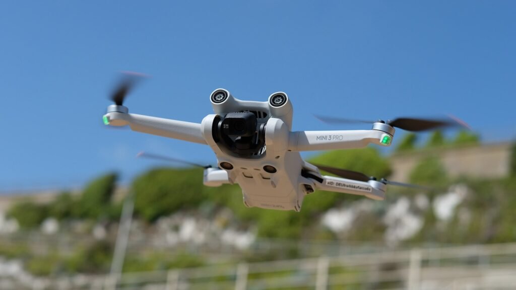
Drone services refer to the use of unmanned aerial vehicles (UAVs) for various applications. These applications can range from aerial photography and videography to surveying and mapping of land areas. In the context of environmental conservation, drone services play a crucial role in monitoring and assessing natural resources, wildlife habitats, and ecosystems. By providing high-resolution imagery and data, drones enable researchers and conservationists to gather valuable information without disturbing the environment. Furthermore, drone services can aid in identifying and addressing environmental issues such as deforestation, pollution, and illegal activities. With their versatility and efficiency, drone services have become an indispensable tool for promoting and enhancing environmental conservation efforts.
Importance of environmental conservation
Environmental conservation plays a crucial role in preserving our planet’s biodiversity and ensuring the sustainability of natural resources. It is of utmost importance to protect and restore ecosystems, as they provide essential services such as clean air, water, and food. By utilizing drone services for environmental conservation, we can enhance our efforts in monitoring and managing fragile ecosystems, identifying and mitigating environmental threats, and conducting research to develop effective conservation strategies. Drones enable us to collect high-resolution data, monitor remote areas, and access hard-to-reach locations, providing valuable insights for conservationists, researchers, and policymakers. With the help of drone technology, we can make significant strides in safeguarding our environment and promoting a sustainable future for generations to come.
Overview of the article
In the article titled ‘Utilizing Drone Services for Environmental Conservation’, the author provides an insightful overview of the various ways in which drones can be used to promote and enhance environmental conservation efforts. The article highlights the potential benefits of utilizing drone technology, such as monitoring wildlife populations, conducting aerial surveys, and detecting illegal activities in protected areas. By harnessing the capabilities of drones, environmental organizations and researchers can gather valuable data and make informed decisions to protect and preserve our natural resources more effectively. This article serves as a comprehensive introduction to the role of drones in environmental conservation and underscores their significant contribution to sustainable practices.
Applications of Drones in Environmental Conservation

Monitoring wildlife populations
Monitoring wildlife populations is a crucial aspect of environmental conservation efforts. Drones have emerged as a valuable tool in this regard, offering a non-intrusive and efficient means of gathering data on various species. By using drones equipped with high-resolution cameras and thermal imaging technology, researchers can monitor wildlife populations from above, capturing detailed images and identifying individual animals. This data can then be used to assess population sizes, track migration patterns, and detect any changes in behavior or habitat. The use of drones for wildlife monitoring not only provides valuable insights into the health and well-being of different species but also helps inform conservation strategies and efforts to protect vulnerable ecosystems.
Mapping and surveying ecosystems
Mapping and surveying ecosystems is a crucial aspect of environmental conservation efforts. By utilizing drone services, researchers and conservationists are able to gather accurate and detailed data about the various ecosystems in a given area. Drones equipped with advanced imaging technology can capture high-resolution images and create precise maps, allowing for a comprehensive understanding of the biodiversity and habitat distribution within an ecosystem. This information is invaluable for identifying areas that require immediate conservation action, as well as monitoring changes over time. Additionally, drone surveys can cover large areas quickly and efficiently, reducing the time and resources required for traditional ground-based surveys. Overall, the use of drone services for mapping and surveying ecosystems enhances our ability to protect and preserve the environment for future generations.
Identifying and addressing environmental threats
Identifying and addressing environmental threats is crucial for effective environmental conservation. With the advent of drone services, this task has become more efficient and accurate. Drones equipped with advanced sensors and cameras can quickly survey vast areas and identify potential threats such as deforestation, pollution, and habitat destruction. Once these threats are identified, appropriate measures can be taken to address them, whether it be through reforestation efforts, implementing stricter regulations, or raising awareness among the public. By utilizing drone services, environmental organizations and government agencies can proactively tackle environmental threats and work towards a sustainable future.
Advantages of Drone Services in Environmental Conservation
Cost-effectiveness and efficiency
Cost-effectiveness and efficiency are key factors to consider when utilizing drone services for environmental conservation. Drones have revolutionized the way data is collected and analyzed, providing a cost-effective and efficient solution compared to traditional methods. By using drones, organizations can survey large areas of land quickly and accurately, reducing the time and resources required for manual surveys. Additionally, drones can access hard-to-reach areas, such as dense forests or remote locations, where traditional methods may be impractical. This not only increases the efficiency of data collection but also minimizes the risks to field workers. Furthermore, the use of drones enables real-time monitoring and analysis, allowing for immediate action to be taken in response to environmental threats. Overall, the cost-effectiveness and efficiency of drone services make them a valuable tool in the pursuit of environmental conservation.
Access to remote and hazardous areas
Access to remote and hazardous areas is one of the key advantages of utilizing drone services for environmental conservation. Drones have the capability to reach areas that are difficult or dangerous for humans to access, such as dense forests, steep cliffs, and contaminated sites. By deploying drones, environmental conservationists can gather valuable data and conduct surveys in these remote locations, providing insights into the state of the environment and helping to identify potential conservation efforts. Furthermore, drones can be equipped with various sensors and cameras, allowing for the collection of high-resolution imagery, thermal data, and even air quality measurements. This information can be used to monitor wildlife populations, detect illegal activities, and assess the impact of human activities on fragile ecosystems. Overall, the use of drones in accessing remote and hazardous areas greatly enhances the efficiency and effectiveness of environmental conservation efforts.
Real-time data collection and analysis
Real-time data collection and analysis is a crucial aspect of utilizing drone services for environmental conservation. Drones equipped with advanced sensors and cameras can gather data on various environmental parameters such as air quality, temperature, and vegetation coverage. This data can be collected in real-time, allowing researchers and conservationists to monitor and analyze environmental changes more efficiently and accurately. By quickly identifying areas of concern, drone technology enables timely interventions and targeted conservation efforts. Moreover, the ability to analyze data in real-time provides valuable insights into the impact of human activities on the environment, helping to inform decision-making and policy formulation for sustainable development. Overall, real-time data collection and analysis through drone services play a vital role in enhancing environmental conservation efforts and promoting a more sustainable future.
Challenges and Limitations of Drone Services
Regulatory restrictions and privacy concerns
Regulatory restrictions and privacy concerns play a significant role in the utilization of drone services for environmental conservation. As drones become more advanced and accessible, government agencies and regulatory bodies have implemented strict rules and regulations to ensure the safe and responsible use of these unmanned aerial vehicles. These restrictions aim to prevent potential hazards and protect the privacy of individuals. Additionally, privacy concerns arise due to the ability of drones to capture images and videos in areas that were previously inaccessible. Striking a balance between the benefits of drone technology and the need for privacy protection is crucial for the successful implementation of drone services in environmental conservation efforts.
Technical limitations and risks
When it comes to utilizing drone services for environmental conservation, there are certain technical limitations and risks that need to be considered. One of the main limitations is the limited battery life of drones, which restricts the amount of time they can spend in the air and collect data. Additionally, drones are susceptible to weather conditions, such as strong winds or heavy rain, which can affect their flight capabilities and potentially damage the equipment. Moreover, there is a risk of drones colliding with birds or other wildlife in the area, which could not only harm the animals but also result in the loss of expensive drone equipment. It is crucial for organizations involved in environmental conservation to carefully assess and manage these technical limitations and risks in order to effectively utilize drone services for their initiatives.
Integration with existing conservation efforts
Integration with existing conservation efforts is crucial for the successful utilization of drone services in environmental conservation. Drones can be integrated into ongoing conservation projects to enhance data collection, monitoring, and analysis. By leveraging the capabilities of drones, conservationists can gather high-resolution imagery, conduct aerial surveys, and track wildlife populations more efficiently and accurately. Additionally, drones can assist in identifying and monitoring areas of concern, such as deforestation or illegal activities, allowing for timely intervention and mitigation measures. The integration of drone services with existing conservation efforts not only improves the effectiveness of conservation strategies but also enables a more comprehensive understanding of environmental issues and supports evidence-based decision-making.
Case Studies: Successful Implementation of Drone Services

Monitoring endangered species in national parks
Monitoring endangered species in national parks is a crucial aspect of environmental conservation. With the help of drone services, researchers and park rangers can efficiently survey vast areas of land and gather data on the presence and behavior of endangered species. Drones equipped with high-resolution cameras and thermal imaging technology can capture detailed images and videos, allowing experts to identify and track these species more accurately. This information is invaluable for understanding population dynamics, identifying conservation priorities, and implementing effective protection measures. By utilizing drone services, we can enhance our efforts to monitor and protect endangered species in national parks, ultimately contributing to their long-term survival and the preservation of biodiversity.
Mapping deforestation and illegal logging activities
Mapping deforestation and illegal logging activities is crucial for effective environmental conservation. By utilizing drone services, we can accurately identify areas where deforestation is occurring and monitor illegal logging activities in real-time. Drones equipped with high-resolution cameras and advanced imaging technology can capture detailed images of the affected areas, providing valuable data for analysis. This data can help authorities take immediate action to prevent further destruction of forests and protect biodiversity. Additionally, the use of drones reduces the need for human intervention in dangerous or inaccessible terrains, ensuring the safety of personnel involved in conservation efforts. Overall, the integration of drone services in mapping deforestation and illegal logging activities enhances our ability to conserve and protect the environment.
Assessing the impact of pollution on water bodies
Water pollution is a significant concern for environmental conservation efforts. Assessing the impact of pollution on water bodies is crucial in understanding the extent of damage caused and implementing effective mitigation strategies. Drone services have emerged as a valuable tool in this process, providing a unique perspective and enabling researchers to collect high-resolution data on water quality and pollution levels. By utilizing drones, scientists can monitor large areas of water bodies more efficiently and accurately, identifying pollution sources and evaluating the overall health of aquatic ecosystems. This information can then be used to develop targeted conservation plans and policies to safeguard our water resources and promote sustainable environmental practices.
Future Trends and Potential of Drone Services in Environmental Conservation

Advancements in drone technology
Advancements in drone technology have revolutionized the field of environmental conservation. With the ability to fly at high altitudes and navigate through difficult terrains, drones have become invaluable tools for monitoring and protecting the environment. These unmanned aerial vehicles are equipped with advanced sensors and cameras, allowing researchers and conservationists to gather accurate data on wildlife populations, habitat conditions, and the impact of human activities on ecosystems. By providing real-time and detailed information, drones enable more efficient and targeted conservation efforts, helping to preserve and restore fragile ecosystems around the world.
Integration with artificial intelligence and machine learning
Integration with artificial intelligence and machine learning has revolutionized the field of drone services for environmental conservation. By combining the power of drones with advanced algorithms and data analysis, organizations can now collect and analyze large amounts of environmental data more efficiently and accurately than ever before. AI and machine learning algorithms can be used to automatically detect and classify various environmental features and phenomena, such as vegetation health, water quality, and animal populations. This integration enables environmental scientists and conservationists to make more informed decisions and take targeted actions to protect and preserve our natural resources. Furthermore, the continuous learning capabilities of AI and machine learning allow for the improvement and refinement of drone services over time, leading to even more effective and sustainable environmental conservation efforts.
Collaboration between drone service providers and conservation organizations
Collaboration between drone service providers and conservation organizations plays a crucial role in advancing environmental conservation efforts. Drones have revolutionized the way data is collected and analyzed, providing valuable insights into the health and status of ecosystems. By working together, drone service providers and conservation organizations can leverage this technology to monitor wildlife populations, identify illegal activities such as poaching and deforestation, and assess the impact of climate change on vulnerable habitats. This collaboration not only enhances the efficiency and effectiveness of conservation efforts but also contributes to the development of innovative solutions for environmental challenges. By harnessing the power of drones, we can better understand and protect our planet’s biodiversity for future generations.


