Introduction
Definition of drone services
Drone services refer to the use of unmanned aerial vehicles (UAVs) for various applications, including surveying. These services have the potential to revolutionize the field of surveying by providing a more efficient and cost-effective way to collect data. With the ability to capture high-resolution images and videos from different angles and heights, drones can quickly and accurately survey large areas of land, reducing the time and manpower required for traditional surveying methods. Additionally, drones can access hard-to-reach or dangerous areas, allowing surveyors to gather data in places that were previously inaccessible. The data collected by drones can be processed and analyzed using advanced software, providing detailed and accurate measurements for various purposes, such as land mapping, construction planning, and environmental monitoring. Overall, the use of drone services in surveying offers tremendous potential for improving efficiency, accuracy, and safety in the industry.
Importance of surveying in various industries
Surveying plays a crucial role in various industries as it provides accurate and detailed information about the physical characteristics of land and structures. In the construction industry, surveying is essential for site planning, design, and monitoring the progress of projects. It helps ensure that buildings and infrastructure are constructed according to specifications and regulations. Surveying is also vital in the mining industry, where it is used to locate and evaluate mineral deposits. Additionally, surveying is important in the agriculture sector for land management, crop planning, and irrigation. With the advent of drone services, surveying has been revolutionized by providing faster and more efficient data collection. Drones can capture high-resolution aerial images, create detailed maps, and collect precise measurements, saving time and resources. The use of drones in surveying has significantly increased accuracy, speed, and safety, making it an invaluable tool in various industries.
Overview of the article
Drones have emerged as a groundbreaking technology that has the potential to revolutionize the field of surveying. In this article, we will explore the various ways in which drone services can transform the surveying industry. From capturing high-resolution aerial images to conducting precise topographic surveys, drones offer a cost-effective and efficient solution for collecting accurate data. Additionally, drones can access hard-to-reach areas and navigate challenging terrains, providing surveyors with a comprehensive view of the land. With their ability to streamline workflows and enhance data accuracy, drone services are poised to reshape the way surveying is conducted, leading to improved efficiency and productivity in the field.
Improved Efficiency

Faster data collection
Drone services have the potential to revolutionize surveying by enabling faster data collection. Traditionally, surveying required manual measurements and on-site visits, which could be time-consuming and labor-intensive. However, with the use of drones, surveyors can now collect data more efficiently and accurately. Drones equipped with high-resolution cameras and sensors can capture detailed images and measurements of the survey area from various angles and heights. This not only saves time but also provides a more comprehensive view of the site. Additionally, drones can cover large areas in a short span of time, reducing the overall surveying duration. The speed and efficiency of data collection with drones can greatly benefit industries such as construction, agriculture, and urban planning, where timely and accurate information is crucial for decision-making. In conclusion, the adoption of drone services in surveying can significantly enhance the speed and effectiveness of data collection, leading to improved project planning and decision-making processes.
Reduced manpower requirements
Reduced manpower requirements is one of the key benefits of using drone services in surveying. Traditionally, surveying required a team of surveyors to manually collect data and measurements on the ground. This process was not only time-consuming but also labor-intensive. However, with the advent of drone technology, surveying can now be done with minimal manpower. Drones equipped with high-resolution cameras and advanced sensors can quickly and accurately capture aerial images and collect data from various angles and heights. This eliminates the need for surveyors to physically access difficult or hazardous terrain, saving time and reducing the risk of accidents. By reducing manpower requirements, drone services have the potential to significantly increase the efficiency and cost-effectiveness of surveying projects.
Real-time monitoring and analysis
Real-time monitoring and analysis is one of the key ways that drone services can revolutionize surveying. With the use of drones, surveyors can gather data and analyze it in real-time, providing instant insights and allowing for quick decision-making. Drones equipped with advanced sensors and cameras can capture high-resolution images and collect accurate data from hard-to-reach areas. This enables surveyors to monitor construction sites, inspect infrastructure, and assess environmental conditions with ease and efficiency. The ability to access real-time data and perform on-site analysis not only saves time and resources but also enhances the accuracy and precision of surveying results. By leveraging drone technology for real-time monitoring and analysis, surveying professionals can streamline their workflow and deliver more reliable and comprehensive survey reports.
Cost Savings

Lower equipment and maintenance costs
Lower equipment and maintenance costs are one of the key advantages that drone services bring to the field of surveying. Traditionally, surveying requires expensive equipment such as total stations and GPS receivers, which can be a significant investment for surveying companies. Additionally, these equipment often require regular maintenance and calibration, which adds to the overall costs. However, with the use of drones, surveying companies can eliminate the need for such expensive equipment and reduce their maintenance costs. Drones are equipped with high-resolution cameras and advanced sensors that can capture accurate data from the air, making them a cost-effective alternative for surveying. By leveraging drone services, surveying companies can save money on equipment purchases and maintenance, allowing them to allocate their resources more efficiently and revolutionize the surveying industry.
Reduced travel expenses
Reduced travel expenses is one of the significant ways drone services can revolutionize surveying. Traditionally, surveying required surveyors to physically travel to the survey site, which often involved long distances and expenses related to transportation, accommodation, and meals. With the use of drones, surveyors can now conduct surveys remotely, eliminating the need for extensive travel. This not only saves time but also reduces costs, making surveying more efficient and cost-effective. By leveraging drone technology, surveying companies can significantly cut down on travel expenses and allocate resources to other important aspects of their projects.
Minimized risk of human error
Drone services have the potential to revolutionize surveying by minimizing the risk of human error. Traditional surveying methods often rely on manual measurements and data collection, which can be prone to mistakes. However, with drones, precise and accurate data can be collected quickly and efficiently. Drones can capture high-resolution images and videos, allowing surveyors to analyze the data with greater detail and accuracy. By reducing human error, drone services not only save time and resources but also improve the overall quality and reliability of surveying results.
Enhanced Safety

Reduced need for human presence in hazardous areas
One of the key benefits of using drone services in surveying is the reduced need for human presence in hazardous areas. Traditionally, surveying required surveyors to physically visit and inspect potentially dangerous sites such as construction sites, mines, or areas with unstable terrain. This posed significant risks to their safety and well-being. However, with the advent of drone technology, surveying can now be conducted remotely, eliminating the need for surveyors to enter these hazardous areas. Drones equipped with high-resolution cameras and sensors can capture detailed images and collect accurate data from above, providing a safer and more efficient alternative. By reducing human presence in hazardous areas, drone services have the potential to revolutionize surveying practices and improve the overall safety of the industry.
Improved risk assessment and mitigation
Improved risk assessment and mitigation is one of the key benefits that drone services bring to the field of surveying. By using drones, surveyors can access hard-to-reach areas and collect data without putting themselves at risk. Drones equipped with high-resolution cameras and sensors can capture detailed images and measurements, allowing surveyors to identify potential hazards and assess risks more accurately. This enables them to develop effective mitigation strategies and make informed decisions to ensure the safety of personnel and equipment. Additionally, drones can quickly detect changes in the environment, such as erosion or unstable terrain, providing real-time information that can help prevent accidents and minimize potential damages. Overall, the use of drone services in surveying significantly enhances risk assessment and mitigation efforts, leading to safer and more efficient surveying operations.
Enhanced emergency response capabilities
Enhanced emergency response capabilities are one of the key ways drone services can revolutionize surveying. With their ability to quickly and efficiently survey large areas from above, drones can provide crucial information to emergency responders in real-time. Whether it’s assessing the extent of a natural disaster, locating missing persons, or monitoring hazardous areas, drones can significantly enhance the effectiveness and speed of emergency response efforts. By providing a bird’s-eye view and collecting valuable data, drones enable responders to make informed decisions and allocate resources more effectively, ultimately saving lives and minimizing damage.
Accurate Data Collection

High-resolution aerial imagery
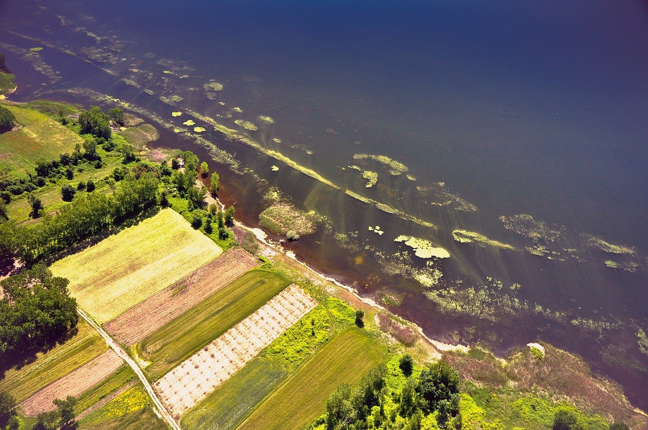
High-resolution aerial imagery is one of the key ways that drone services can revolutionize surveying. Drones equipped with high-quality cameras can capture detailed images from above, providing a comprehensive view of the surveyed area. This allows surveyors to gather accurate data and identify potential issues or areas of interest with precision. By utilizing drone technology, surveying companies can save time and resources, as well as improve the overall accuracy and efficiency of their surveys. High-resolution aerial imagery opens up new possibilities for surveying, enabling professionals to obtain a wealth of information in a faster and more cost-effective manner.
Precise mapping and measurements
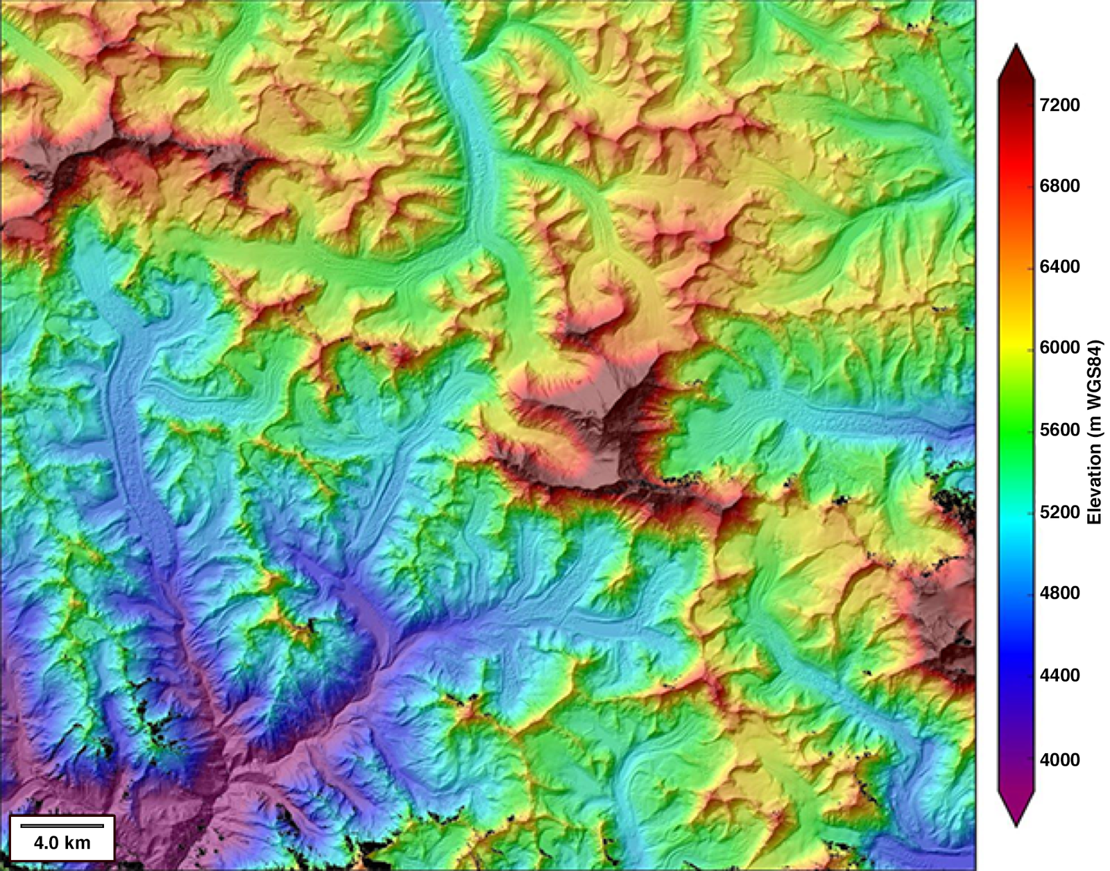
Precise mapping and measurements are one of the key areas where drone services can revolutionize surveying. Drones equipped with advanced sensors and cameras can capture high-resolution images and collect accurate data, allowing for more detailed and precise mapping of areas. This not only saves time and effort but also improves the accuracy of measurements. With drones, surveyors can quickly and efficiently gather data from difficult-to-reach locations, such as steep terrains or inaccessible areas. The ability to obtain precise mapping and measurements through drone services opens up new possibilities for various industries, including construction, land management, and environmental monitoring.
Detailed 3D modeling
Detailed 3D modeling is one of the key ways that drone services can revolutionize surveying. With the ability to capture high-resolution aerial images and create accurate 3D models, drones can provide surveyors with a comprehensive view of a site or structure. This allows for more precise measurements, better visualization, and improved decision-making. Additionally, drone-based 3D modeling can save time and reduce costs compared to traditional surveying methods. By quickly capturing data from multiple angles and generating detailed models, drones streamline the surveying process and enable faster analysis and reporting. Overall, the use of drones for detailed 3D modeling in surveying has the potential to greatly enhance efficiency and accuracy in the field.
Versatility

Suitability for various terrains and environments
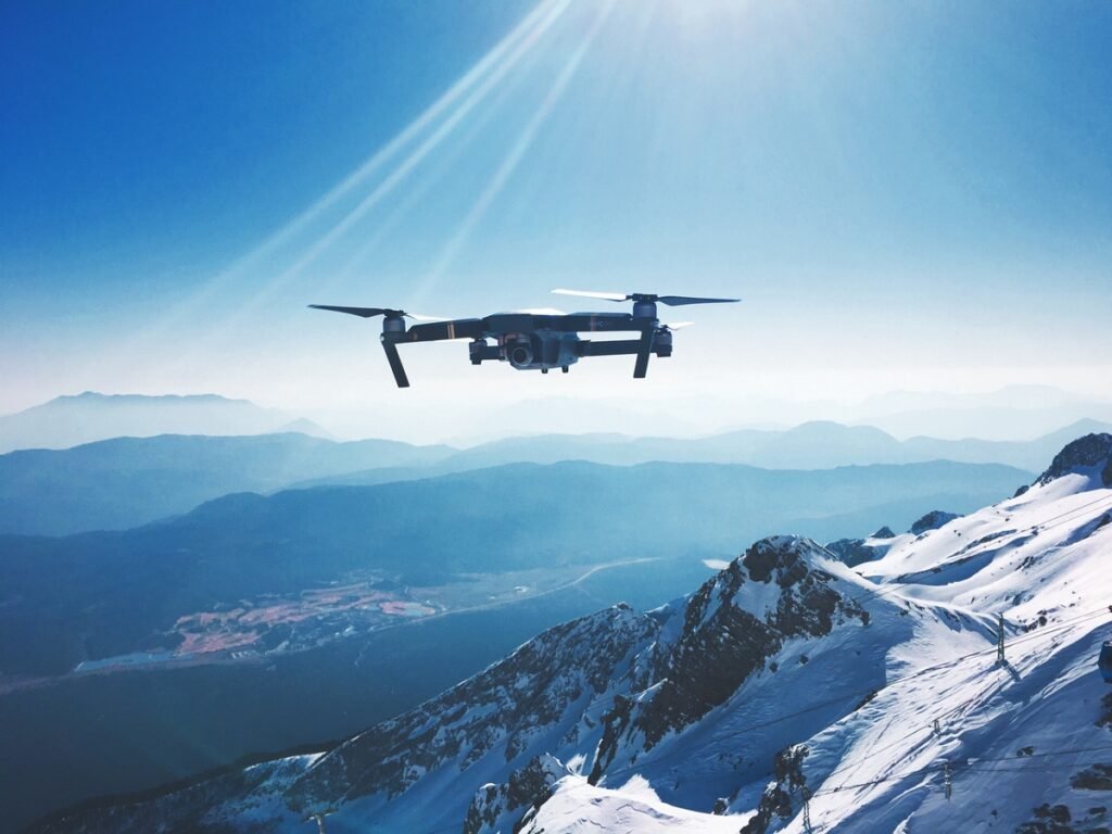
Drone services have the potential to revolutionize surveying due to their suitability for various terrains and environments. Unlike traditional surveying methods, drones can easily navigate through challenging landscapes such as rugged mountains, dense forests, or inaccessible areas. This allows surveyors to gather accurate data from locations that were previously difficult or dangerous to reach. Additionally, drones are equipped with advanced sensors and cameras that can capture high-resolution images and collect detailed information about the land. This enables surveyors to create precise maps and models, helping them make informed decisions and plan more efficiently. With their versatility and adaptability, drone services offer an innovative and efficient solution for surveying tasks in diverse terrains and environments.
Ability to access hard-to-reach areas
The ability of drone services to access hard-to-reach areas is one of the key ways they can revolutionize surveying. Traditional surveying methods often require surveyors to physically access difficult or dangerous locations, such as steep slopes, tall buildings, or remote areas. This can be time-consuming, costly, and even risky. However, drones equipped with high-resolution cameras and advanced sensors can easily navigate and capture data from these challenging areas. By using drones, surveyors can gather accurate and detailed information without putting themselves in harm’s way. This not only improves efficiency and reduces costs but also enhances safety in surveying operations. The ability to access hard-to-reach areas is a game-changer for the surveying industry, enabling more comprehensive and precise data collection for various applications including construction, land management, and environmental assessment.
Compatibility with different surveying techniques
Drone services have the potential to revolutionize surveying by offering compatibility with different surveying techniques. Traditional surveying methods often require manual measurements and can be time-consuming and labor-intensive. However, drones equipped with advanced imaging technology can quickly and accurately capture data from various angles and heights. This compatibility allows surveyors to obtain more detailed and comprehensive information, leading to more accurate results and improved decision-making. Additionally, drones can access hard-to-reach areas, such as rugged terrains or hazardous environments, making surveying safer and more efficient. With their versatility and adaptability, drone services are poised to transform the field of surveying and enhance its capabilities.


